|
search place name
|
||
Mangol (Iran)Mangol is a town in Iran. An overview map of the region around Mangol is displayed below.
regional and 3d topo map of Mangol, Iran ::

Mangol airports ::
The nearest airport is ZBR - Chah Bahar, located 220.9 km south east of Mangol.
Nearby towns ::
Deh-e Kahvarnī (0.6km west) //
Gārū (1.2km north) //
Pūzgī (1.2km west) //
Band-e Jalāl (1.6km south west) //
Rameshk (2.3km south west) //
Moghān Sheyb (2.5km north east) //
Deh Kalak (4.1km south east) //
Kallehgān (5.4km south) //
Dapkūlak (5.8km south) //
Bon Sūr (6.4km south) //
Deh Bālā (6.7km south) //
Gol Moḩammad (6.4km south west) //
Darzeh (7.8km west) //
Darzeh (7.8km west) //
Būm (8.9km south east) //
Gīāhān (9.5km north west) //
Zīārat (10.3km north west) //
[all distances 'as the bird flies' and approximate] 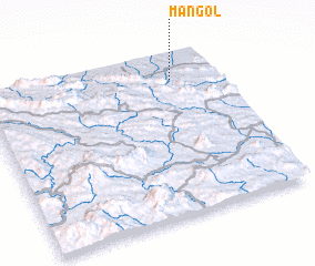 Places with similar names to Mangol, Iran ::
// Managale (MM)
// Mangla (MM)
// Mān Ka-lao (MM)
// Mān Kalu (MM)
// Mān Nawkla (MM)
// Maungla (MM)
// Maunglaw (MM)
// Mingala (MM)
// Mingala (MM)
// Möng La (MM)
Disclaimer :: Information on this page comes without warranty of any kind |
||
|
Where is Mangol? Elevation and coordinates ::
Latitude (lat): 26°51'0"N Longitude (lon): 58°49'0"E
Elevation (approx.): 694m (map arrows pan, magnifying glasses zoom) |
||
|
Visiting Mangol? Hotel/Accommodation ::
Book a hotel in Mangol Travel Guide ::
Buy a travel guide for Iran rental cars ::
car rental offers GPS waypoint ::
download a GPX waypoint (PoI) of Mangol for your GPS receiver
|
||