|
search place name
|
||
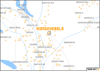
Mīān Deh-e Bālā (Kermān, Iran)Mīān Deh-e Bālā is a town in the Kermān region of Iran. An overview map of the region around Mīān Deh-e Bālā is displayed below.
regional and 3d topo map of Mīān Deh-e Bālā, Iran ::
Mīān Deh-e Bālā airports ::
The nearest airport is KER - Kerman, located 203.7 km north west of Mīān Deh-e Bālā.
Other airports nearby include BND - Bandar Abbass Intl (208.6 km south west), Nearby towns ::
Dowlatābād (0.7km west) //
Dehkadeh-ye Numūneh (1.1km south) //
Kahnak (1.2km west) //
Bāqerābād (1.6km east) //
Bīd Kheyrī (1.9km north) //
Na‘lbandī (1.9km south) //
Deh Now (1.9km south) //
Deh Sheykh (2.5km north east) //
Sāgharī (2.9km south) //
Kot-e Gorg Ābī Sanjarī (3.7km south) //
Mīān Deh-e Pā'īn (3.7km south) //
Zeydābād-e Kahnak (3.3km west) //
Jalālābād (3.7km south) //
Chaman (3.7km south west) //
Raẕīābād (3.8km north west) //
Bāqerābād (4.0km north west) //
Gāsholkhī (3.7km south west) //
Kahnak-e Salmānzādeh (3.7km west) //
Allāhābād (3.8km west) //
Do Boneh (4.4km south west) //
Zīrakī (4.4km south west) //
Qanāt Kalāntar (4.9km south) //
Jangalābād (4.9km north) //
Ḩoseynābād (4.9km south west) //
Gazābād (5.4km north west) //
Deh-e Now (5.8km south) //
Dowlatābād (5.8km south) //
S̄om Gāvān (5.8km north) //
Sarānī-ye Bālā (5.8km south) //
[all distances 'as the bird flies' and approximate] 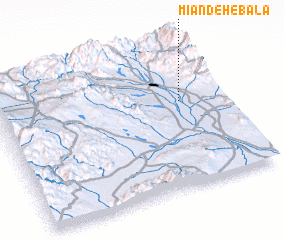 Places with similar names to Mīān Deh-e Bālā, Iran :: Disclaimer :: Information on this page comes without warranty of any kind |
||
|
Where is Mīān Deh-e Bālā? Elevation and coordinates ::
Latitude (lat): 28°36'0"N Longitude (lon): 57°49'0"E
Elevation (approx.): 642m (map arrows pan, magnifying glasses zoom) |
||
|
Visiting Mīān Deh-e Bālā? Hotel/Accommodation ::
Book a hotel in Mīān Deh-e Bālā Travel Guide ::
Buy a travel guide for Iran rental cars ::
car rental offers GPS waypoint ::
download a GPX waypoint (PoI) of Mīān Deh-e Bālā for your GPS receiver
|
||