|
search place name
|
||
Mījān-e Pā'īn (Kermān, Iran)Mījān-e Pā'īn is a town in the Kermān region of Iran. An overview map of the region around Mījān-e Pā'īn is displayed below.
regional and 3d topo map of Mījān-e Pā'īn, Iran ::

Mījān-e Pā'īn airports ::
The nearest airport is KER - Kerman, located 199.6 km north west of Mījān-e Pā'īn.
Other airports nearby include BND - Bandar Abbass Intl (225.6 km south west), Nearby towns ::
Sar Jangal (1.1km north west) //
Mījān-e Bālā (1.3km north east) //
Esfedān (2.3km north) //
Darbīdān (2.5km north east) //
Bāgh Kūcheh (2.3km west) //
Bon Kūh Pā'īn (2.7km east) //
Koldān (2.9km west) //
‘Ezzatābād (3.4km north) //
Sar Āsīāb-e Mījān (3.3km west) //
Darūjīn (4.0km north west) //
Ponkūh (3.7km east) //
Sar Kalū (4.9km south west) //
Garmeshk (5.6km south) //
Rad Kūh (5.8km north) //
Pātomhā (5.6km south west) //
Moḩammadābād-e Ḩīshīn (7.4km south) //
Sībak-e Sūrān (7.6km north) //
Ḩīshīn (8.2km south) //
Kesht (8.2km north) //
Kahgū (8.2km north west) //
Jūr Haft (8.3km north east) //
[all distances 'as the bird flies' and approximate] 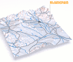 Places with similar names to Mījān-e Pā'īn, Iran :: Disclaimer :: Information on this page comes without warranty of any kind |
||
|
Where is Mījān-e Pā'īn? Elevation and coordinates ::
Latitude (lat): 28°42'0"N Longitude (lon): 57°57'0"E
Elevation (approx.): 1717m (map arrows pan, magnifying glasses zoom) |
||
|
Visiting Mījān-e Pā'īn? Hotel/Accommodation ::
Book a hotel in Mījān-e Pā'īn Travel Guide ::
Buy a travel guide for Iran rental cars ::
car rental offers GPS waypoint ::
download a GPX waypoint (PoI) of Mījān-e Pā'īn for your GPS receiver
|
||