|
search place name
|
||
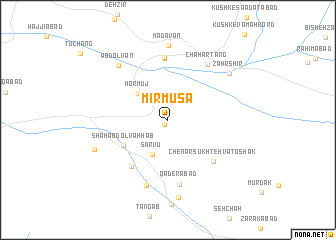
Mīr Mūsá (Fārs, Iran)Mīr Mūsá is a town in the Fārs region of Iran. An overview map of the region around Mīr Mūsá is displayed below.
regional and 3d topo map of Mīr Mūsá, Iran ::
Mīr Mūsá airports ::
The nearest airport is SYZ - Shiraz Shahid Dastghaib Intl, located 161.6 km north west of Mīr Mūsá.
Other airports nearby include KIH - Kish Island (221.4 km south), BDH - Bandar Lengeh (243.2 km south east), Nearby towns ::
Denīān (0.6km south west) //
Sar Vū (4.1km south) //
Hormūj (4.2km north west) //
Shāh ‘Abd ol Vahhāb (5.2km south west) //
Khorramābād (6.3km south west) //
Bābā ‘Arab (6.8km north) //
Chenār Sūkhteh va Toshak (6.4km south east) //
‘Alavīyeh (7.0km north) //
Qāderābād (7.3km south) //
Chahār Tang (7.3km north east) //
Āb Anjīr va Bas Kūtūk (7.6km south) //
‘Abd ol Van (7.8km north west) //
Mādavān (8.4km north) //
Z̧ahr Shīr (8.0km north east) //
Chāh-e Anjīr (8.7km south) //
Ronjekū va Seh Darreh (8.0km south west) //
[all distances 'as the bird flies' and approximate] 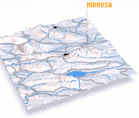 Places with similar names to Mīr Mūsá, Iran ::
Disclaimer :: Information on this page comes without warranty of any kind |
||
|
Where is Mīr Mūsá? Elevation and coordinates ::
Latitude (lat): 28°30'57"N Longitude (lon): 53°46'19"E
Elevation (approx.): 1439m (map arrows pan, magnifying glasses zoom) |
||
|
Visiting Mīr Mūsá? Hotel/Accommodation ::
Book a hotel in Mīr Mūsá Travel Guide ::
Buy a travel guide for Iran rental cars ::
car rental offers GPS waypoint ::
download a GPX waypoint (PoI) of Mīr Mūsá for your GPS receiver
|
||