|
search place name
|
||
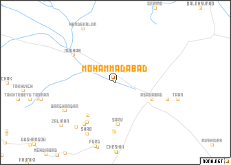
Moḩammadābād (Khorāsān, Iran)Moḩammadābād is a town in the Khorāsān region of Iran. An overview map of the region around Moḩammadābād is displayed below.
regional and 3d topo map of Moḩammadābād, Iran ::
Moḩammadābād airports ::
The nearest airport is XBJ - Birjand, located 66.5 km west of Moḩammadābād.
Nearby towns ::
Asadābād (5.7km south east) //
Sarv (6.8km south) //
Gerow (6.9km south) //
Kalāteh-ye Bāqer Khān (6.6km south west) //
Bowrg (8.0km south) //
Chāh Dūk (7.6km south west) //
Arreh (8.0km south) //
Arreh Fūrg (8.0km south) //
Nūghāb (7.3km north west) //
Esmā‘īlābād (8.0km south west) //
Ţāghān (7.7km east) //
Barghandān (8.3km south west) //
Shāb (9.2km south west) //
Bākandū (8.4km south west) //
Bonīāb (9.0km south west) //
Hendevālān (9.7km north west) //
Zalīrān (10.2km south west) //
[all distances 'as the bird flies' and approximate]  Places with similar names to Moḩammadābād, Iran ::
// Muhammadābād (IN)
// Muhammadābād (IN)
// Muhammadābād (IN)
// Muhammadābād (IN)
// Muhammadābād (IN)
// Muhammadābād (IN)
// Moḩammadābād (IR)
// Moḩammadābād (IR)
// Moḩammadābād (IR)
// Moḩammadābād (IR)
Disclaimer :: Information on this page comes without warranty of any kind |
||
|
Where is Moḩammadābād? Elevation and coordinates ::
Latitude (lat): 32°56'30"N Longitude (lon): 59°58'30"E
Elevation (approx.): 1529m (map arrows pan, magnifying glasses zoom) |
||
|
Visiting Moḩammadābād? Hotel/Accommodation ::
Book a hotel in Moḩammadābād Travel Guide ::
Buy a travel guide for Iran rental cars ::
car rental offers GPS waypoint ::
download a GPX waypoint (PoI) of Moḩammadābād for your GPS receiver
|
||