|
search place name
|
||
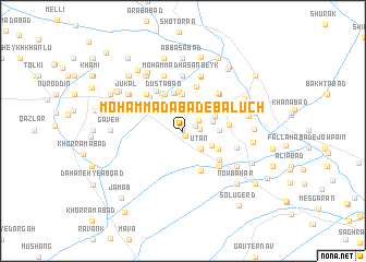
Moḩammadābād-e Balūch (Khorāsān, Iran)Moḩammadābād-e Balūch is a town in the Khorāsān region of Iran. An overview map of the region around Moḩammadābād-e Balūch is displayed below.
regional and 3d topo map of Moḩammadābād-e Balūch, Iran ::
Moḩammadābād-e Balūch airports ::
The nearest airport is ASB - Ashkhabad Ashgabat, located 166.4 km north west of Moḩammadābād-e Balūch.
Nearby towns ::
Dastgerd (0.1km north west) //
Kaslānī (0.5km south) //
‘Abbāsābād-e Jangī (0.5km south) //
Sebūseh (1.2km north east) //
Mehdīābād (1.4km east) //
Kamālābād (1.9km north) //
Āq Şaḩrā (1.7km north east) //
Jūqān (2.2km north) //
Zanāqol (2.3km north) //
Īl Ḩeşār (2.3km south east) //
Ūţān (2.4km south east) //
Sar Āsīāb (2.6km east) //
Ūţān (2.7km south east) //
Mehdīābād (3.0km north east) //
Mehdī Solţān (3.0km north east) //
Zohāb (3.0km east) //
Ḩājjīābād (3.7km north) //
Keremgān (3.7km north) //
Ḩājjīābād (3.9km north) //
Ḩasanābād-e Khān (3.9km north) //
Qal‘eh Now (4.0km north) //
Kalāteh-ye Sheykhhā (3.5km south east) //
Dūstābād (4.0km north) //
Chambar Gharbāl (4.0km north) //
Dūstābād (4.0km north) //
Kabīr (4.0km north) //
Chambar Gharbāl (4.2km north west) //
Gol Khandān (4.2km north west) //
Ḩoseyn Najū (4.3km south) //
[all distances 'as the bird flies' and approximate] 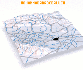 Places with similar names to Moḩammadābād-e Balūch, Iran :: Disclaimer :: Information on this page comes without warranty of any kind |
||
|
Where is Moḩammadābād-e Balūch? Elevation and coordinates ::
Latitude (lat): 36°37'59"N Longitude (lon): 59°10'0"E
Elevation (approx.): 1163m (map arrows pan, magnifying glasses zoom) |
||
|
Visiting Moḩammadābād-e Balūch? Hotel/Accommodation ::
Book a hotel in Moḩammadābād-e Balūch Travel Guide ::
Buy a travel guide for Iran rental cars ::
car rental offers GPS waypoint ::
download a GPX waypoint (PoI) of Moḩammadābād-e Balūch for your GPS receiver
|
||