|
search place name
|
||
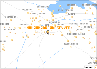
Moḩammadābād-e Seyyed (Kermān, Iran)Moḩammadābād-e Seyyed is a town in the Kermān region of Iran. An overview map of the region around Moḩammadābād-e Seyyed is displayed below.
regional and 3d topo map of Moḩammadābād-e Seyyed, Iran ::
Moḩammadābād-e Seyyed airports ::
The nearest airport is KER - Kerman, located 226.3 km north west of Moḩammadābād-e Seyyed.
Nearby towns ::
Jannatābād (0.7km east) //
Arjomand (1.5km east) //
Kāmrānīyeh (1.6km north west) //
Baz̄rābād (1.5km east) //
Moḩammadābād-e Āb Shīrīn (1.8km north east) //
Qaşr (2.4km north) //
Choghūkābād (2.2km north west) //
Khvājehābād (2.8km north) //
‘Alīābād-e A‘lā' (3.0km north west) //
Qal‘eh-ye ‘Azīzābād (4.1km north) //
Deh-e Vasaţ (3.9km north east) //
Shamsābād (3.8km west) //
Hasanābād (4.3km north east) //
Deh Mīān-e ‘Azīzābād (4.4km north east) //
Qāʼemābād (4.5km north west) //
Moḩammadābād (4.3km west) //
Mīrābād (4.5km east) //
Akbarābād (4.5km east) //
Qal‘eh Khān (4.6km west) //
‘Azīzābād-e Pā'īn (4.8km north east) //
Deh Now (5.0km north east) //
Shāhrokhābād (5.6km north) //
Kheyrābād (5.0km west) //
Deh-e Shūr (5.9km north) //
Morādābād (6.0km north) //
Ḩasanābād (5.9km north west) //
Rostamābād (6.1km north) //
Ḩoseynābād (6.2km north west) //
Za‘īmābād (6.6km north) //
[all distances 'as the bird flies' and approximate] 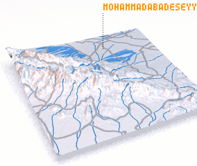 Places with similar names to Moḩammadābād-e Seyyed, Iran :: Disclaimer :: Information on this page comes without warranty of any kind |
||
|
Where is Moḩammadābād-e Seyyed? Elevation and coordinates ::
Latitude (lat): 28°54'32"N Longitude (lon): 58°41'16"E
Elevation (approx.): 787m (map arrows pan, magnifying glasses zoom) |
||
|
Visiting Moḩammadābād-e Seyyed? Hotel/Accommodation ::
Book a hotel in Moḩammadābād-e Seyyed Travel Guide ::
Buy a travel guide for Iran rental cars ::
car rental offers GPS waypoint ::
download a GPX waypoint (PoI) of Moḩammadābād-e Seyyed for your GPS receiver
|
||