|
search place name
|
||
Moḩammad Ţāherī (Ostān-e Būshehr, Iran)Moḩammad Ţāherī is a town in the Ostān-e Būshehr region of Iran. An overview map of the region around Moḩammad Ţāherī is displayed below.
regional and 3d topo map of Moḩammad Ţāherī, Iran ::

Moḩammad Ţāherī airports ::
The nearest airport is BUZ - Bushehr, located 38.4 km west of Moḩammad Ţāherī.
Other airports nearby include SYZ - Shiraz Shahid Dastghaib Intl (157.1 km north east), Nearby towns ::
Shūrekī (1.9km north) //
Someyl ‘Alī (2.5km south east) //
Abol (2.7km north) //
Sādenī (2.5km east) //
Kāyed Ebrāhīmī (3.4km south east) //
Anbārak (3.8km north) //
Bāghcheh (3.5km east) //
Moḩammad Jamālī (4.0km north west) //
Golakī (4.1km south east) //
Konān Derow (4.6km south east) //
Qanbarī (4.7km south east) //
Mardābād (5.8km north) //
Aḩsham-e ‘Alī Aḩmad Khīārī (6.2km north) //
Bāgh-e Gap (6.2km north) //
Aḩshām-e Zā‘er Teymūr (7.2km north) //
Aḩshām-e ‘Alī Moḩammad Qāsem (7.6km north) //
Zīād Māl (8.1km north west) //
Kangarī (8.1km north west) //
Chahār Tol (8.1km north west) //
Aḩshām-e Zā‘er Karam (8.1km north west) //
Ālī Ḩoseynī (8.1km south east) //
Ahram (10.0km north east) //
Kashk-e Tū (11.0km north west) //
[all distances 'as the bird flies' and approximate] 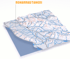 Places with similar names to Moḩammad Ţāherī, Iran :: Disclaimer :: Information on this page comes without warranty of any kind |
||
|
Where is Moḩammad Ţāherī? Elevation and coordinates ::
Latitude (lat): 28°49'0"N Longitude (lon): 51°12'0"E
Elevation (approx.): 57m (map arrows pan, magnifying glasses zoom) |
||
|
Visiting Moḩammad Ţāherī? Hotel/Accommodation ::
Book a hotel in Moḩammad Ţāherī Travel Guide ::
Buy a travel guide for Iran rental cars ::
car rental offers GPS waypoint ::
download a GPX waypoint (PoI) of Moḩammad Ţāherī for your GPS receiver
|
||