|
search place name
|
||
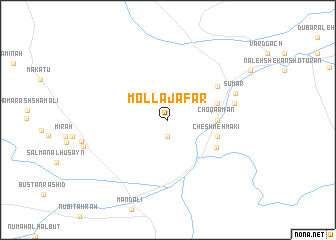
Mollā Ja‘far (Ostān-e Kermānshāh, Iran)Mollā Ja‘far is a town in the Ostān-e Kermānshāh region of Iran. An overview map of the region around Mollā Ja‘far is displayed below.
regional and 3d topo map of Mollā Ja‘far, Iran ::
Mollā Ja‘far airports ::
The nearest airport is KSH - Bakhtaran Shahid Ashrafi Esfahani, located 156.1 km east of Mollā Ja‘far.
Other airports nearby include SDG - Sanandaj (204.2 km north east), Nearby towns ::
Pasgāh-e Sūmār (1.9km south) //
Choqā Amān (4.6km east) //
Cheshmeh Makī (5.0km east) //
Neybahān (5.0km east) //
Mīān Tang (5.5km south east) //
Nā'īn (5.9km north east) //
Mamar Do (5.9km north east) //
Gazīn (6.4km east) //
Sūmār (6.9km north east) //
[all distances 'as the bird flies' and approximate]  Places with similar names to Mollā Ja‘far, Iran :: Disclaimer :: Information on this page comes without warranty of any kind |
||
|
Where is Mollā Ja‘far? Elevation and coordinates ::
Latitude (lat): 33°50'0"N Longitude (lon): 45°35'0"E
Elevation (approx.): 295m (map arrows pan, magnifying glasses zoom) |
||
|
Visiting Mollā Ja‘far? Hotel/Accommodation ::
Book a hotel in Mollā Ja‘far Travel Guide ::
Buy a travel guide for Iran rental cars ::
car rental offers GPS waypoint ::
download a GPX waypoint (PoI) of Mollā Ja‘far for your GPS receiver
|
||