|
search place name
|
||
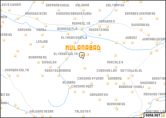
Mūlānābād (Ostān-e Kermānshāh, Iran)Mūlānābād is a town in the Ostān-e Kermānshāh region of Iran. An overview map of the region around Mūlānābād is displayed below.
regional and 3d topo map of Mūlānābād, Iran ::
Mūlānābād airports ::
The nearest airport is SDG - Sanandaj, located 54.7 km north west of Mūlānābād.
Other airports nearby include KSH - Bakhtaran Shahid Ashrafi Esfahani (59.1 km south), Nearby towns ::
Kal Sefīd (1.4km north east) //
Sīr Kūh (2.1km south) //
Elyāsān-e ‘Olyā (3.0km west) //
Kandeh Sorkh (3.0km west) //
Asadābād (4.0km north) //
Dogolbandeh (3.6km north east) //
Cheshmeh Gīlān (3.6km north west) //
Elyāsān-e Soflá (4.1km north) //
Cheshmeh Tūrān (5.8km south) //
Chahār Melān (4.9km west) //
Noşratābād (6.3km north east) //
Charkhalān (5.9km south east) //
Posht-e Darband (5.9km south west) //
Āgāh-e Soflá (6.4km north west) //
Āgāh-e ‘Olyā (7.0km north) //
‘Alīābād (6.9km south) //
Cheshmeh-ye Bahāʼ od Dīn (6.0km east) //
Cheshmeh Qoţ (7.4km south) //
Marzāleh (6.4km east) //
Talkhestān (7.6km south) //
Sīrdūleh (6.4km west) //
Pīr Doāb (6.4km west) //
Āsemān Dūl (7.2km south east) //
Choqerchāh (7.1km north east) //
Ḩeydarābād (8.0km north) //
Darband (8.2km south east) //
Vardārān (8.7km north east) //
Samanbān (10.2km north west) //
[all distances 'as the bird flies' and approximate] 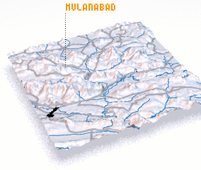 Places with similar names to Mūlānābād, Iran ::
Disclaimer :: Information on this page comes without warranty of any kind |
||
|
Where is Mūlānābād? Elevation and coordinates ::
Latitude (lat): 34°51'0"N Longitude (lon): 47°22'0"E
Elevation (approx.): 1776m (map arrows pan, magnifying glasses zoom) |
||
|
Visiting Mūlānābād? Hotel/Accommodation ::
Book a hotel in Mūlānābād Travel Guide ::
Buy a travel guide for Iran rental cars ::
car rental offers GPS waypoint ::
download a GPX waypoint (PoI) of Mūlānābād for your GPS receiver
|
||