|
search place name
|
||
Na‘lkonān (Khūzestān, Iran)Na‘lkonān is a town in the Khūzestān region of Iran. An overview map of the region around Na‘lkonān is displayed below.
regional and 3d topo map of Na‘lkonān, Iran ::

Na‘lkonān airports ::
The nearest airport is QMJ - Masjed Soleiman Shahid Asyaee, located 87.7 km west of Na‘lkonān.
Other airports nearby include AWZ - Ahwaz (139.5 km west), MRX - Bandar Mahshahr Mahshahr (163.1 km south west), ABD - Abadan (238.8 km south west), Nearby towns ::
Shālū (0.2km east) //
Derāz Darreh (1.0km south) //
Kal Khvājeh-ye Soflá (1.3km south) //
Sarkān (1.4km west) //
Rak‘at-e Soflá (1.4km west) //
Mūrd (1.7km south) //
Kolmot Shālū (1.6km north west) //
Sar Darreh (1.9km south) //
Kalkhūnagdūn (2.1km south) //
Bājūl (2.0km south west) //
Tang-e Qāf (2.0km south west) //
Pātāveh (2.0km north west) //
Aḩmadābād (2.3km south) //
Rak‘at-e ‘Olyā (2.3km north west) //
Marghā (2.6km south) //
Bardarū (2.7km north west) //
Āb Gonjeshkī (3.4km south) //
Zīr Kūh-e Shālū (3.2km north west) //
Balūţak Shālū (3.4km south west) //
Mīāngarān (3.8km south) //
Gavīleh (3.9km south) //
Darreh Khaşī (4.0km south east) //
Darreh Jehūd (4.0km south) //
Mūrd (4.2km south) //
Kohrelā (4.2km south) //
Seyyed Anjīrī (3.9km south west) //
Tang-e Rīg (4.2km south west) //
Shūshtarī (4.7km south) //
Chel Kīrā (4.8km south west) //
[all distances 'as the bird flies' and approximate] 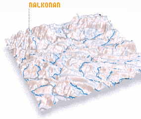 Places with similar names to Na‘lkonān, Iran :: Disclaimer :: Information on this page comes without warranty of any kind |
||
|
Where is Na‘lkonān? Elevation and coordinates ::
Latitude (lat): 31°45'5"N Longitude (lon): 50°8'58"E
Elevation (approx.): 850m (map arrows pan, magnifying glasses zoom) |
||
|
Visiting Na‘lkonān? Hotel/Accommodation ::
Book a hotel in Na‘lkonān Travel Guide ::
Buy a travel guide for Iran rental cars ::
car rental offers GPS waypoint ::
download a GPX waypoint (PoI) of Na‘lkonān for your GPS receiver
|
||