|
search place name
|
||
Nārān (Kermān, Iran)Nārān is a town in the Kermān region of Iran. An overview map of the region around Nārān is displayed below.
regional and 3d topo map of Nārān, Iran ::

Nārān airports ::
The nearest airport is KER - Kerman, located 118.7 km north of Nārān.
Other airports nearby include BND - Bandar Abbass Intl (233.0 km south), Nearby towns ::
Galūmonān (1.3km west) //
Morrīn (3.0km north) //
Darreh Sīveh (3.4km north east) //
Darreh-e Mīveh (3.4km north east) //
Bāgh-e Ebrāhīm (3.7km north east) //
Sang-e Sabz (4.0km north) //
Bahr Āsmān (4.4km south east) //
Murreh (6.2km north) //
Galū Gāzer (6.4km north east) //
Shaghīn (6.5km south west) //
Mowrū'īyeh (6.3km east) //
Deh Kahīrī (6.3km east) //
Seyyed Morteẕá (6.6km west) //
Khvoshāb (6.7km east) //
Seghīn (7.3km south west) //
Z̧ohrbanān (8.0km north) //
Dubār (7.6km east) //
Eshkanū'īyeh (8.2km north east) //
Gelūchār (8.7km north) //
Deh Konārī (7.8km east) //
Noşratābād (8.0km north west) //
Chāleh (8.2km north west) //
Qalandarān (8.8km north east) //
Esfārch (8.4km north east) //
Khāk-e Sefīd (8.8km north east) //
Sīāh Gerd (9.4km north west) //
Sarhanger (9.7km north east) //
Darreh Rūd (9.7km north east) //
Qanāt-e Malek (10.4km north west) //
[all distances 'as the bird flies' and approximate] 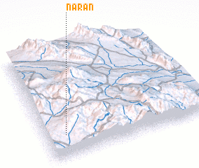 Places with similar names to Nārān, Iran ::
Disclaimer :: Information on this page comes without warranty of any kind |
||
|
Where is Nārān? Elevation and coordinates ::
Latitude (lat): 29°12'52"N Longitude (lon): 57°7'20"E
Elevation (approx.): 2523m (map arrows pan, magnifying glasses zoom) |
||
|
Visiting Nārān? Hotel/Accommodation ::
Book a hotel in Nārān Travel Guide ::
Buy a travel guide for Iran rental cars ::
car rental offers GPS waypoint ::
download a GPX waypoint (PoI) of Nārān for your GPS receiver
|
||