|
search place name
|
||
Naşrābād (Khorāsān, Iran)Naşrābād is a town in the Khorāsān region of Iran. An overview map of the region around Naşrābād is displayed below.
regional and 3d topo map of Naşrābād, Iran ::

Nearby towns ::
Kārīzak-e Nāgahānī (1.3km north west) //
Qal‘eh Ney (1.6km south east) //
Ḩoseynābād (2.5km south west) //
Kalāteh-ye Kāl Sār (2.3km west) //
Shahnābād (2.5km east) //
Kalāteh-ye Sa‘īd (3.0km south east) //
Kalāteh-ye Zanganeh (3.4km south) //
Ardū (3.4km south) //
‘Abas̄ābād (3.7km south west) //
‘Alīābād (3.4km south west) //
Kang-e Pā'īn (3.5km south east) //
Ḩājjīābād (3.8km west) //
Dūrūk (4.3km south east) //
Nūrābād (4.1km south west) //
Ḩeşār (4.7km south east) //
Kang-e Bālā (4.0km east) //
Sīāh Sang (5.0km south) //
Mīrābād (4.4km east) //
Nīāzābād (5.0km south east) //
Kalāteh-ye Kāl Sorkh (5.6km south east) //
Kang-e Zeytūn (5.3km east) //
Karīmābād (5.5km west) //
Esmā‘īlābād (5.5km west) //
Zāveh (6.5km south east) //
Deh Now (7.0km south east) //
Kārīz-e Bālā (6.6km east) //
Gholābād (7.2km south east) //
Şebī (8.0km south east) //
Talkhī (8.1km south east) //
[all distances 'as the bird flies' and approximate] 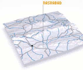 Places with similar names to Naşrābād, Iran ::
Disclaimer :: Information on this page comes without warranty of any kind |
||
|
Where is Naşrābād? Elevation and coordinates ::
Latitude (lat): 35°17'52"N Longitude (lon): 59°24'4"E
Elevation (approx.): 1359m (map arrows pan, magnifying glasses zoom) |
||
|
Visiting Naşrābād? Hotel/Accommodation ::
Book a hotel in Naşrābād Travel Guide ::
Buy a travel guide for Iran rental cars ::
car rental offers GPS waypoint ::
download a GPX waypoint (PoI) of Naşrābād for your GPS receiver
|
||