|
search place name
|
||
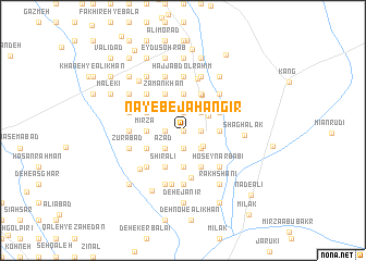
Nāyeb-e Jahāngīr (Sīstān va Balūchestān, Iran)Nāyeb-e Jahāngīr is a town in the Sīstān va Balūchestān region of Iran. An overview map of the region around Nāyeb-e Jahāngīr is displayed below.
regional and 3d topo map of Nāyeb-e Jahāngīr, Iran ::
Nāyeb-e Jahāngīr airports ::
The nearest airport is ZAH - Zahedan Intl, located 195.5 km south west of Nāyeb-e Jahāngīr.
Nearby towns ::
Mollā Raḩmat (0.0km north) //
Yār Moḩammad-e ‘Alam (0.0km north) //
Yār Moḩammad-e Şafar Zā'ī (1.6km west) //
Ţāvūs (1.9km north) //
Gol Beyk (1.9km north) //
Khadrī (1.9km north) //
Mīrzā ‘Alī (1.6km east) //
Ḩājjī Nabī (1.9km south) //
Ḩājjī Mīrzā Khān (1.9km south) //
Tahāneh (2.4km south east) //
Dād Zarī (2.4km north east) //
Nīk Moḩammad (2.4km north east) //
Gholām Moḩammad (2.4km north east) //
Āzād (2.4km south west) //
‘Azīz-e Bāmadī (2.4km south west) //
Ḩājjī Gol Moḩammad Khān (2.4km south east) //
Shaghālak (2.4km south east) //
Karīm Khān (2.7km north east) //
Jahānābād-e Bālā (3.2km west) //
Khāneh-ye Delmorād (3.7km north) //
Mīrzā (3.2km west) //
Ḩeydar-e Pūdīneh (3.7km north) //
Mūsá Khān (3.7km north) //
Deh-e Nūr Moḩammad (3.2km west) //
Mollā Solţān (3.7km north) //
Ḩakīm Rīgī (3.2km east) //
Jom‘eh-ye A‘z̧am (3.7km south) //
Kondel (3.7km south) //
Jahānābād-e Pā'īn (3.7km south) //
[all distances 'as the bird flies' and approximate]  Places with similar names to Nāyeb-e Jahāngīr, Iran :: Disclaimer :: Information on this page comes without warranty of any kind |
||
|
Where is Nāyeb-e Jahāngīr? Elevation and coordinates ::
Latitude (lat): 31°4'0"N Longitude (lon): 61°47'0"E
Elevation (approx.): 483m (map arrows pan, magnifying glasses zoom) |
||
|
Visiting Nāyeb-e Jahāngīr? Hotel/Accommodation ::
Book a hotel in Nāyeb-e Jahāngīr Travel Guide ::
Buy a travel guide for Iran rental cars ::
car rental offers GPS waypoint ::
download a GPX waypoint (PoI) of Nāyeb-e Jahāngīr for your GPS receiver
|
||