|
search place name
|
||
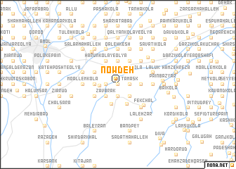
Now Deh (Iran)Now Deh is a town in Iran. An overview map of the region around Now Deh is displayed below.
regional and 3d topo map of Now Deh, Iran ::
Now Deh airports ::
The nearest airport is THR - Teheran Mehrabad Intl, located 131.6 km south west of Now Deh.
Other airports nearby include RZR - Ramsar (168.9 km west), Nearby towns ::
Tīr Kolā (0.0km north) //
Tamask (1.5km east) //
Nez̧āmābād (1.9km north) //
Kharman Kolā (1.5km west) //
Mazres (1.9km south) //
Sorkh Kolā (2.4km north east) //
Āhangar Kolā (2.4km south east) //
Shahneh Kolā (2.4km south west) //
Zavārak (2.4km south west) //
Pāshā Kolā (2.4km west) //
Kom Darreh (3.2km south) //
Vostā Kolā (3.3km south) //
Chang Mīān-e Pā'īn (3.0km east) //
Ejbār Kolā-ye Pā'īn (3.7km north) //
Chang Mīān (3.0km east) //
Gol Mazār (3.0km east) //
Gol Mazār (3.0km east) //
Khūnī Sar (3.7km north) //
Mīleh (3.0km west) //
Bakī (4.0km north) //
Hārūn Kolā-ye ‘Olyā (4.0km north) //
Hārūn Kolā-ye Soflá (4.0km north) //
Najjār Maḩalleh (4.0km north) //
Mahdī Kheyl (3.5km north west) //
Zavārak (3.5km south west) //
Moz̧affar Kolā (4.8km north east) //
Khaţīb (4.8km north east) //
Vosţá Kolā (4.8km south east) //
Fek Chāl (4.8km south east) //
[all distances 'as the bird flies' and approximate] 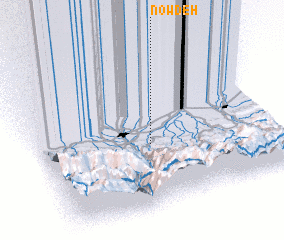 Places with similar names to Now Deh, Iran ::
Disclaimer :: Information on this page comes without warranty of any kind |
||
|
Where is Now Deh? Elevation and coordinates ::
Latitude (lat): 36°25'0"N Longitude (lon): 52°28'0"E
Elevation (approx.): 65m (map arrows pan, magnifying glasses zoom) |
||
|
Visiting Now Deh? Hotel/Accommodation ::
Book a hotel in Now Deh Travel Guide ::
Buy a travel guide for Iran rental cars ::
car rental offers GPS waypoint ::
download a GPX waypoint (PoI) of Now Deh for your GPS receiver
|
||