|
search place name
|
||
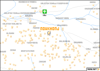
Nowkhonj (Khorāsān, Iran)Nowkhonj is a town in the Khorāsān region of Iran. An overview map of the region around Nowkhonj is displayed below.
regional and 3d topo map of Nowkhonj, Iran ::
Nowkhonj airports ::
The nearest airport is XBJ - Birjand, located 9.1 km north of Nowkhonj.
Nearby towns ::
Mezg (0.6km west) //
Ja‘farīyeh (0.9km south east) //
Fūdāj (1.4km south west) //
Kalāteh-ye Rajab ‘Alī Ḩabīb (1.8km north) //
‘Alīābād-e Lūleh (1.8km north west) //
Kalāteh-ye Mīr ‘Alī (2.2km south) //
Kalāteh-ye ‘Abdollāh (2.2km south west) //
Mehtarān (2.6km south) //
Esfahrūd (2.3km south east) //
Tangal-e Pā'īn (2.2km east) //
Kalāteh-ye Karbalā'ī Ḩasan (2.5km south west) //
Zīrūchī-ye Pā'īn (3.0km south east) //
Kalāteh-ye Mollā (3.0km south west) //
Razg (3.0km south west) //
Tag-e Zard (2.9km west) //
Ḩājjī Ma‘şūm (2.9km west) //
Kalāteh-ye Bābā (3.0km west) //
Sonbol (3.7km south) //
Kalāteh-ye ‘Alī Ḩeydar (3.1km west) //
Kalāteh-ye Nāyeb Rajab (3.3km east) //
Ākholgāh (4.1km south) //
Farrāshband (3.6km north west) //
Tangal-ye Nuk (4.1km south) //
Qorbān (4.1km south) //
Cheshmeh-ye ‘Alī (4.1km south west) //
Harsīshk (4.1km south west) //
Sahlābād (4.1km south east) //
Sar-e Pol (3.7km west) //
Jīmābād (4.3km south east) //
[all distances 'as the bird flies' and approximate] 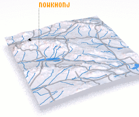 Places with similar names to Nowkhonj, Iran :: Disclaimer :: Information on this page comes without warranty of any kind |
||
|
Where is Nowkhonj? Elevation and coordinates ::
Latitude (lat): 32°49'3"N Longitude (lon): 59°17'1"E
Elevation (approx.): 1650m (map arrows pan, magnifying glasses zoom) |
||
|
Visiting Nowkhonj? Hotel/Accommodation ::
Book a hotel in Nowkhonj Travel Guide ::
Buy a travel guide for Iran rental cars ::
car rental offers GPS waypoint ::
download a GPX waypoint (PoI) of Nowkhonj for your GPS receiver
|
||