|
search place name
|
||
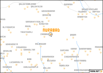
Nūrābād (Lorestān, Iran)Nūrābād is a town in the Lorestān region of Iran. An overview map of the region around Nūrābād is displayed below.
regional and 3d topo map of Nūrābād, Iran ::
Nūrābād airports ::
The nearest airport is QMJ - Masjed Soleiman Shahid Asyaee, located 199.1 km south of Nūrābād.
Other airports nearby include THR - Teheran Mehrabad Intl (272.8 km north east), Nearby towns ::
Borj (0.7km north) //
Ẕīā'ābād (2.2km west) //
‘Aẕodīyeh (4.4km north west) //
Palangdar (4.9km south west) //
Aşgharābād (4.9km east) //
Kharājī (5.8km north) //
Sabz Sanakhtī ‘Olyā (6.3km north west) //
Qeshlāq (7.1km north) //
Gūrchak (7.1km south east) //
Ertaleq-eQobā (7.4km south east) //
Sar Sakhtī-ye ‘Olyā (6.9km north west) //
Qāqān (6.5km east) //
Borj-e Cheshmeh-ye Maḩmūd (7.4km south west) //
Shāh Pahneh (8.4km south) //
Do Khvāḩarān (8.5km north) //
Pākal (7.7km west) //
Bīdestān (8.8km south) //
Dāvūd-e Peyghambar (9.0km south) //
Avarnālūq (9.1km south) //
Kapar (8.6km south east) //
Sīāh Solţān (8.9km south west) //
Chāh Bor (9.2km south east) //
Choghā Pahneh (10.3km south east) //
[all distances 'as the bird flies' and approximate]  Places with similar names to Nūrābād, Iran ::
Disclaimer :: Information on this page comes without warranty of any kind |
||
|
Where is Nūrābād? Elevation and coordinates ::
Latitude (lat): 33°47'36"N Longitude (lon): 49°24'56"E
Elevation (approx.): 2174m (map arrows pan, magnifying glasses zoom) |
||
|
Visiting Nūrābād? Hotel/Accommodation ::
Book a hotel in Nūrābād Travel Guide ::
Buy a travel guide for Iran rental cars ::
car rental offers GPS waypoint ::
download a GPX waypoint (PoI) of Nūrābād for your GPS receiver
|
||