|
search place name
|
||
Orjanlī (Iran)Orjanlī is a town in Iran. An overview map of the region around Orjanlī is displayed below.
regional and 3d topo map of Orjanlī, Iran ::
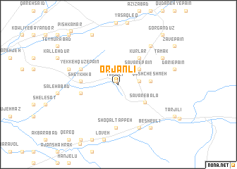
Nearby towns ::
Tarjīlī (0.6km north west) //
Dūmānlī (2.6km north east) //
Savār-e Vasaţ (2.6km east) //
Savār-e Pā'īn (3.5km north east) //
Savār-e Bālā (4.3km south east) //
Qūsh Cheshmeh (4.1km east) //
Kūrlar (4.9km north east) //
Ḩājjī Golshan (4.8km west) //
Ḩājjī Ḩasan (4.8km west) //
Kāz̧em Khvājeh (4.8km west) //
Sheykh Hā (4.8km west) //
Goneylī (4.9km west) //
Yekkeh Qūz-e Bālā (5.3km north west) //
Yekkeh Qūz-e Pā'īn (5.3km north west) //
Shoqāl Tappeh (6.9km south) //
Gūgol-e Bozorg (7.4km south) //
Rameẕānābād (7.4km south) //
Khūjeh Yāpāqī (7.3km north east) //
Tamak (7.0km north east) //
Ḩeydarābād (6.7km west) //
Besh Evlī (8.0km south east) //
Kaser-e Pīshkamar (8.6km north west) //
Loveh (9.0km south) //
Dārī-e Pāʼīn (7.4km east) //
Esteqlāl (9.4km south) //
Tarjīlī (8.7km south east) //
Gorgāndūz (9.7km north east) //
Qānjeq Shahrak (10.0km south west) //
Ḩājjīābād (10.0km south west) //
[all distances 'as the bird flies' and approximate] 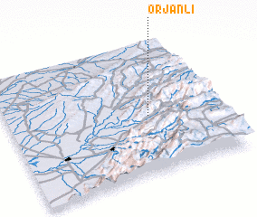 Places with similar names to Orjanlī, Iran :: Disclaimer :: Information on this page comes without warranty of any kind |
||
|
Where is Orjanlī? Elevation and coordinates ::
Latitude (lat): 37°26'44"N Longitude (lon): 55°40'14"E
Elevation (approx.): 692m (map arrows pan, magnifying glasses zoom) |
||
|
Visiting Orjanlī? Hotel/Accommodation ::
Book a hotel in Orjanlī Travel Guide ::
Buy a travel guide for Iran rental cars ::
car rental offers GPS waypoint ::
download a GPX waypoint (PoI) of Orjanlī for your GPS receiver
|
||