|
search place name
|
||
Pachet (Iran)Pachet is a town in Iran. An overview map of the region around Pachet is displayed below.
regional and 3d topo map of Pachet, Iran ::

Nearby towns ::
Sheykh Nūr od Dīn (1.1km west) //
Pārem (1.3km east) //
Sheykh Maḩalleh (2.2km west) //
Metkāzīn (3.4km south east) //
Pārch (4.0km south east) //
Owlār (4.7km north) //
Pajīm (4.5km north west) //
Par Kolā (4.6km south west) //
Sūrak (5.1km south) //
Samchūl (5.3km south) //
Evārd (5.3km north east) //
Gornām (4.9km east) //
Gālesh Maḩalleh (5.2km west) //
Zelet (5.6km north west) //
Yārasm (6.9km south) //
Āhangar Kolā (7.2km south) //
Bermā-ye ‘Ashrostāq (7.1km south) //
Jīrband (7.4km south) //
Bīsheh Boneh (6.1km east) //
Gharīb Maḩalleh (6.2km west) //
Ramadān (6.7km north east) //
Jūrband va Jīrband (7.8km south) //
Chāneh Pol (6.7km east) //
Shīler (7.1km south east) //
Lamrad (7.9km south east) //
Moḩsenābād (7.4km south west) //
Velū (8.4km south) //
Vāvodīn (7.7km south west) //
Kord Maḩalleh (8.7km south east) //
[all distances 'as the bird flies' and approximate] 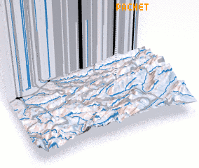 Places with similar names to Pachet, Iran ::
Disclaimer :: Information on this page comes without warranty of any kind |
||
|
Where is Pachet? Elevation and coordinates ::
Latitude (lat): 36°34'52"N Longitude (lon): 53°44'42"E
Elevation (approx.): 1055m (map arrows pan, magnifying glasses zoom) |
||
|
Visiting Pachet? Hotel/Accommodation ::
Book a hotel in Pachet Travel Guide ::
Buy a travel guide for Iran rental cars ::
car rental offers GPS waypoint ::
download a GPX waypoint (PoI) of Pachet for your GPS receiver
|
||