|
search place name
|
||
Pīrvalī (Hamadān, Iran)Pīrvalī is a town in the Hamadān region of Iran. An overview map of the region around Pīrvalī is displayed below.
regional and 3d topo map of Pīrvalī, Iran ::

Pīrvalī airports ::
The nearest airport is SDG - Sanandaj, located 160.5 km west of Pīrvalī.
Other airports nearby include KSH - Bakhtaran Shahid Ashrafi Esfahani (171.3 km south west), RZR - Ramsar (261.9 km north east), Nearby towns ::
Nowābād (0.0km north) //
Parvaraq (1.9km north) //
Kerdābād (2.7km east) //
Vīān (5.2km south) //
Rāmīshān (4.8km north east) //
Dāqdāqābād (5.1km north east) //
Khal‘atābād (4.5km east) //
Khānābād (5.8km north) //
Ḩātamābād (6.3km south west) //
Yeserlū (7.6km south) //
Kabūdar Āhang (7.8km north west) //
Gondeh Jīn (7.1km north west) //
‘Eynābād (8.2km south east) //
Mazra‘eh (8.2km south west) //
[all distances 'as the bird flies' and approximate] 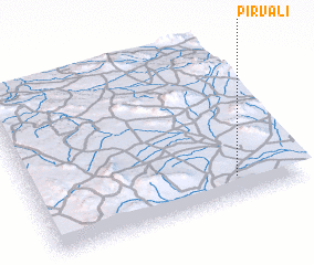 Places with similar names to Pīrvalī, Iran ::
// Peiroval (BR)
// Perryville (US)
// Perryville (US)
// Perryville (US)
// Perryville (US)
// Perryville (US)
// Perryville (US)
// Priefel (DE)
// Prevalle (IT)
// Paravóla (GR)
Disclaimer :: Information on this page comes without warranty of any kind |
||
|
Where is Pīrvalī? Elevation and coordinates ::
Latitude (lat): 35°8'0"N Longitude (lon): 48°46'0"E
Elevation (approx.): 1646m (map arrows pan, magnifying glasses zoom) |
||
|
Visiting Pīrvalī? Hotel/Accommodation ::
Book a hotel in Pīrvalī Travel Guide ::
Buy a travel guide for Iran rental cars ::
car rental offers GPS waypoint ::
download a GPX waypoint (PoI) of Pīrvalī for your GPS receiver
|
||