|
search place name
|
||
Pol Sar (Iran)Pol Sar is a town in Iran. An overview map of the region around Pol Sar is displayed below.
regional and 3d topo map of Pol Sar, Iran ::
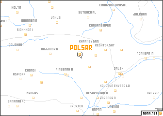
Nearby towns ::
Tūyeh (2.5km south east) //
Khar Meydān (3.1km north east) //
Estakhr Sar (2.7km east) //
Namakeh (4.7km south west) //
Pīr Ebrāhīm (4.8km south west) //
Kesht Dasht (4.8km north east) //
Ḩājjī Kord (5.9km west) //
Chaman Sāver (7.4km north east) //
Emāmzādeh Moḩammad (7.1km south east) //
Qal‘eh (7.9km south east) //
Vāmūzī (9.4km north west) //
Kalā Būneh-ye Bālā (9.8km south east) //
[all distances 'as the bird flies' and approximate] 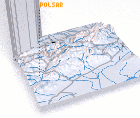 Places with similar names to Pol Sar, Iran ::
// Pelzer (US)
// Pällussaare (EE)
// Põllussaare (EE)
// Pullisaare (EE)
// Pellicer (CU)
// Pelişor (RO)
// Pelişor (RO)
// Plăişoru (RO)
// Pleşcioara (RO)
// Policiori (RO)
Disclaimer :: Information on this page comes without warranty of any kind |
||
|
Where is Pol Sar? Elevation and coordinates ::
Latitude (lat): 36°28'0"N Longitude (lon): 54°9'0"E
Elevation (approx.): 2109m (map arrows pan, magnifying glasses zoom) |
||
|
Visiting Pol Sar? Hotel/Accommodation ::
Book a hotel in Pol Sar Travel Guide ::
Buy a travel guide for Iran rental cars ::
car rental offers GPS waypoint ::
download a GPX waypoint (PoI) of Pol Sar for your GPS receiver
|
||