|
search place name
|
||
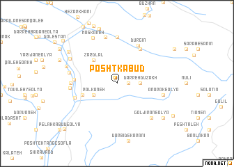
Posht Kabūd (Ostān-e Kermānshāh, Iran)Posht Kabūd is a town in the Ostān-e Kermānshāh region of Iran. An overview map of the region around Posht Kabūd is displayed below.
regional and 3d topo map of Posht Kabūd, Iran ::
Posht Kabūd airports ::
The nearest airport is KSH - Bakhtaran Shahid Ashrafi Esfahani, located 53.3 km north of Posht Kabūd.
Other airports nearby include SDG - Sanandaj (154.0 km north), Nearby towns ::
Dehvand (1.5km east) //
Darreh Dūzakh (3.1km east) //
Palkāneh (3.6km south west) //
Zardlal (4.8km north west) //
Sar Jūb-e Jalāvand (5.0km west) //
Vīnah (6.4km north east) //
Khūb Yārān-e Soflá (5.8km west) //
Dūrgīn (6.7km north east) //
Galīāneh-ye ‘Alī Bāqer (6.1km west) //
Cheshmeh Shāhrokh (7.4km north) //
Sar Jūb (6.2km west) //
Sar Jūb-e ‘Olyā (6.3km west) //
Tāzehābād (7.6km north) //
Anārak-e Soflá (6.4km east) //
Anārak-e ‘Olyā (6.4km east) //
Khūb Yārān-e ‘Olyā (6.5km west) //
Gol Jīrān-e ‘Olyā (7.2km south east) //
Maskareh (8.0km north west) //
Mīmī (7.2km west) //
Talal (7.4km north west) //
Masgareh (9.1km north) //
Gol Jīrān-e Soflá (8.3km south east) //
Dūr Dasht (8.2km north west) //
Chenār (10.0km north west) //
Pelah Kabūd-e Soflá (10.2km south west) //
[all distances 'as the bird flies' and approximate] 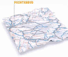 Places with similar names to Posht Kabūd, Iran ::
// Posht Kabūd (IR)
Disclaimer :: Information on this page comes without warranty of any kind |
||
|
Where is Posht Kabūd? Elevation and coordinates ::
Latitude (lat): 33°52'0"N Longitude (lon): 47°12'0"E
Elevation (approx.): 1228m (map arrows pan, magnifying glasses zoom) |
||
|
Visiting Posht Kabūd? Hotel/Accommodation ::
Book a hotel in Posht Kabūd Travel Guide ::
Buy a travel guide for Iran rental cars ::
car rental offers GPS waypoint ::
download a GPX waypoint (PoI) of Posht Kabūd for your GPS receiver
|
||