|
search place name
|
||
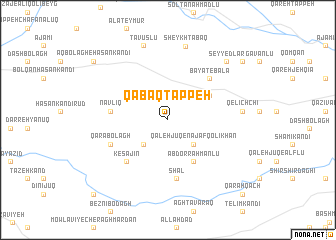
Qābāq Tappeh (Ostān-e Āz̄arbāyjān-e Sharqī, Iran)Qābāq Tappeh is a town in the Ostān-e Āz̄arbāyjān-e Sharqī region of Iran. An overview map of the region around Qābāq Tappeh is displayed below.
regional and 3d topo map of Qābāq Tappeh, Iran ::
Qābāq Tappeh airports ::
The nearest airport is TBZ - Tabriz Intl, located 126.4 km north west of Qābāq Tappeh.
Nearby towns ::
Tāzeh Kand (3.5km south west) //
Qal‘eh Jūq-e Najafqolī Khān (3.6km south east) //
Khātūnābād (4.1km north west) //
‘Abd or Raḩmānlū (5.1km south east) //
Kolūjeh-ye Ghamī (4.6km north east) //
Nāvlīq (5.2km west) //
Kesajīn (5.9km south west) //
Shāl (6.5km south) //
Bayāt-e Bālā (5.9km north east) //
Qarā Bolāgh (5.8km south west) //
Qelīch Chī (6.7km east) //
Sheykh Ţabaq (8.4km north) //
Ţāvūslū (8.6km north) //
Seyyedlar (8.3km north east) //
Āqbolāgh-e Ḩasan Kandī (9.3km north west) //
Bayāt-e Soflá (9.3km north east) //
Beznī-ye Cherāgh Mardān (10.6km south west) //
Qarah Qāch (10.7km south east) //
[all distances 'as the bird flies' and approximate] 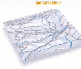 Places with similar names to Qābāq Tappeh, Iran ::
// Kabagtepe (AZ)
// Qabaqtǝpǝ (AZ)
// Kabaktepe (TR)
// Kabaktepe (TR)
// Kabaktepe (TR)
// Gūbak Tappeh (IR)
// Qābākh Tappeh (IR)
// Qābākh Tappeh (IR)
// Qābāq Tappeh (IR)
// Kabakhtapa (AM)
Disclaimer :: Information on this page comes without warranty of any kind |
||
|
Where is Qābāq Tappeh? Elevation and coordinates ::
Latitude (lat): 37°24'30"N Longitude (lon): 47°20'29"E
Elevation (approx.): 1868m (map arrows pan, magnifying glasses zoom) |
||
|
Visiting Qābāq Tappeh? Hotel/Accommodation ::
Book a hotel in Qābāq Tappeh Travel Guide ::
Buy a travel guide for Iran rental cars ::
car rental offers GPS waypoint ::
download a GPX waypoint (PoI) of Qābāq Tappeh for your GPS receiver
|
||