|
search place name
|
||
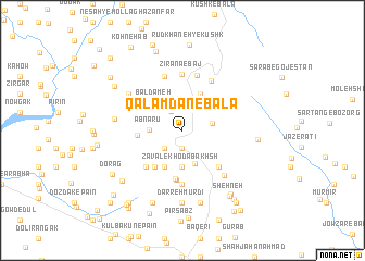
Qalamdān-e Bālā (Fārs, Iran)Qalamdān-e Bālā is a town in the Fārs region of Iran. An overview map of the region around Qalamdān-e Bālā is displayed below.
regional and 3d topo map of Qalamdān-e Bālā, Iran ::
Qalamdān-e Bālā airports ::
The nearest airport is SYZ - Shiraz Shahid Dastghaib Intl, located 142.0 km south east of Qalamdān-e Bālā.
Other airports nearby include BUZ - Bushehr (171.4 km south), Nearby towns ::
Deh Derāz (1.9km south) //
Parzeh (2.2km north west) //
Bondareh (2.4km south west) //
Ābshār (2.7km east) //
Āb Nārū (3.0km west) //
Eshkoftestān (3.6km south) //
Tang-e Zavāl (3.7km south) //
Zavāl-e Khodā Bakhsh (3.7km south) //
Zavāl-e Bālā (3.7km south) //
Sar-e Sīl-e Zavāl (3.7km south) //
Bāldameh (3.7km north west) //
Līrū (4.0km south west) //
Āb Sefīd (4.0km north east) //
Reẕā (4.1km west) //
Khodābakhsh (4.5km south west) //
Neyseh Anjīreh (5.0km south) //
Gūrāb Kūh (5.1km south) //
Delī-ye Rangak (4.9km south west) //
Qanāt (4.9km south east) //
Zavāl (5.6km south) //
Zīr ‘Anā'-e Baj (5.7km north) //
Khezr-e Harandān (5.8km north) //
Keveshk-e Pā'īn (5.8km north) //
Mūrkā (5.7km north east) //
Anjīreh (5.9km south east) //
Tāveh Taḩt (6.1km north west) //
Āb Anjīr (6.1km west) //
Darreh Mūrdī (7.4km south) //
Nārenjān (7.6km south) //
[all distances 'as the bird flies' and approximate] 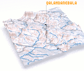 Places with similar names to Qalamdān-e Bālā, Iran :: Disclaimer :: Information on this page comes without warranty of any kind |
||
|
Where is Qalamdān-e Bālā? Elevation and coordinates ::
Latitude (lat): 30°23'0"N Longitude (lon): 51°29'0"E
Elevation (approx.): 1733m (map arrows pan, magnifying glasses zoom) |
||
|
Visiting Qalamdān-e Bālā? Hotel/Accommodation ::
Book a hotel in Qalamdān-e Bālā Travel Guide ::
Buy a travel guide for Iran rental cars ::
car rental offers GPS waypoint ::
download a GPX waypoint (PoI) of Qalamdān-e Bālā for your GPS receiver
|
||