|
search place name
|
||
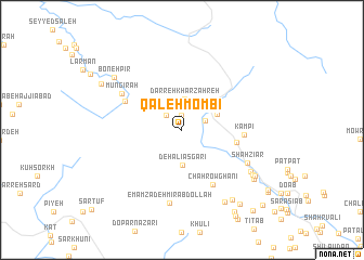
Qal‘eh Mombī (Ostān-e Kohgīlūyeh va Būyer Aḩmad, Iran)Qal‘eh Mombī is a town in the Ostān-e Kohgīlūyeh va Būyer Aḩmad region of Iran. An overview map of the region around Qal‘eh Mombī is displayed below.
regional and 3d topo map of Qal‘eh Mombī, Iran ::
Qal‘eh Mombī airports ::
The nearest airport is MRX - Bandar Mahshahr Mahshahr, located 110.9 km south west of Qal‘eh Mombī.
Other airports nearby include QMJ - Masjed Soleiman Shahid Asyaee (127.6 km north west), AWZ - Ahwaz (131.6 km west), ABD - Abadan (198.6 km south west), Nearby towns ::
Chamtāj (0.9km north) //
Tang-e Gūr (1.0km north) //
Meleh Cherī (1.5km north) //
Darreh Bīd (2.0km north west) //
Pārah Ardeshīr (2.3km north east) //
Tang Anjīr (2.6km north) //
Darreh Kharzahreh (3.2km north) //
Deh ‘Alī ‘Asgarī (3.7km south) //
Dūrāb (3.5km north east) //
Bājereh (3.7km north east) //
Mūrūn (5.0km east) //
Kampī (5.5km east) //
Chāh Rowghanī (6.3km south east) //
Dalī Chāh Zālū (5.8km north west) //
Mūngīrah (6.5km north west) //
Shāh Zīār (6.7km south east) //
Emāmzādeh Mīr ‘Abdollāh (7.6km south) //
Dūrāk (7.5km south east) //
Pas Bāgh (7.7km south east) //
Darreh Zarī (8.4km south east) //
Boneh Pīr (8.1km north west) //
Boneh-ye Sardār (8.5km south east) //
Shāh Valī (8.0km south east) //
Cheshmeh-ye Amīrī (8.2km south east) //
Gach Gerd (8.6km north west) //
Barchū (9.2km south east) //
Kachlān (9.6km south east) //
Sa‘ādatābād (9.7km south east) //
Māmā Zeynāb (10.4km south east) //
[all distances 'as the bird flies' and approximate]  Places with similar names to Qal‘eh Mombī, Iran ::
// KuLombombo (ZA)
// Kīlmama (ET)
// Kelimamoa (MG)
// Kalumbami (CD)
// Kilimbimu (CD)
// Kolomboma (CD)
// Galoumboma (CG)
// Gol Mīm (IR)
// Gul Imām (PK)
// Qal‘eh Ḩammām (IR)
Disclaimer :: Information on this page comes without warranty of any kind |
||
|
Where is Qal‘eh Mombī? Elevation and coordinates ::
Latitude (lat): 31°6'35"N Longitude (lon): 50°7'4"E
Elevation (approx.): 1222m (map arrows pan, magnifying glasses zoom) |
||
|
Visiting Qal‘eh Mombī? Hotel/Accommodation ::
Book a hotel in Qal‘eh Mombī Travel Guide ::
Buy a travel guide for Iran rental cars ::
car rental offers GPS waypoint ::
download a GPX waypoint (PoI) of Qal‘eh Mombī for your GPS receiver
|
||