|
search place name
|
||
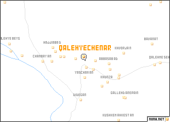
Qal‘eh-ye Chenār (Fārs, Iran)Qal‘eh-ye Chenār is a town in the Fārs region of Iran. An overview map of the region around Qal‘eh-ye Chenār is displayed below.
regional and 3d topo map of Qal‘eh-ye Chenār, Iran ::
Qal‘eh-ye Chenār airports ::
The nearest airport is SYZ - Shiraz Shahid Dastghaib Intl, located 121.4 km south west of Qal‘eh-ye Chenār.
Other airports nearby include AZD - Yazd Shahid Sadooghi (187.1 km north east), Nearby towns ::
Qanāt-e Now (1.4km south) //
Āq Cheshmeh (1.9km west) //
Moz̧affarābād (1.9km east) //
Ālmāt Borj (2.4km south east) //
Yās Chaman (3.6km south) //
Fīrūzī (4.1km west) //
‘Abbāsābād (4.6km east) //
Sar Tom (4.7km west) //
Tīrūd (5.1km east) //
Fotūḩābād (6.4km south east) //
Fotūḩābād (6.4km south east) //
Khūnzā (6.3km south east) //
Khūnzā (6.3km south east) //
Aḩmadābād (6.0km west) //
Ḩājjī Dād (6.3km west) //
Ḩājjīābād (6.8km north west) //
Khowrkosh (7.2km south east) //
Khowrkosh (7.2km south east) //
Jūk Sini (7.4km south east) //
Dīdegān (8.6km south) //
Khvorjān (7.5km east) //
Galleh Dār-e Bālā (10.9km south east) //
Galleh Dār-e Bālā (10.9km south east) //
Galleh Dār-e Pā'īn (11.1km south east) //
[all distances 'as the bird flies' and approximate] 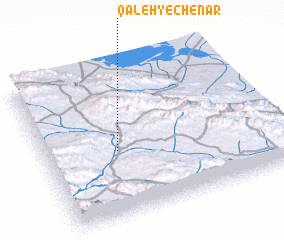 Places with similar names to Qal‘eh-ye Chenār, Iran :: Disclaimer :: Information on this page comes without warranty of any kind |
||
|
Where is Qal‘eh-ye Chenār? Elevation and coordinates ::
Latitude (lat): 30°26'0"N Longitude (lon): 53°19'0"E
Elevation (approx.): 2259m (map arrows pan, magnifying glasses zoom) |
||
|
Visiting Qal‘eh-ye Chenār? Hotel/Accommodation ::
Book a hotel in Qal‘eh-ye Chenār Travel Guide ::
Buy a travel guide for Iran rental cars ::
car rental offers GPS waypoint ::
download a GPX waypoint (PoI) of Qal‘eh-ye Chenār for your GPS receiver
|
||