|
search place name
|
||
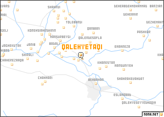
Qal‘eh-ye Taqī (Khūzestān, Iran)Qal‘eh-ye Taqī is a town in the Khūzestān region of Iran. An overview map of the region around Qal‘eh-ye Taqī is displayed below.
regional and 3d topo map of Qal‘eh-ye Taqī, Iran ::
Qal‘eh-ye Taqī airports ::
The nearest airport is MRX - Bandar Mahshahr Mahshahr, located 102.6 km west of Qal‘eh-ye Taqī.
Other airports nearby include AWZ - Ahwaz (158.5 km north west), QMJ - Masjed Soleiman Shahid Asyaee (174.9 km north west), ABD - Abadan (193.3 km west), BUZ - Bushehr (198.2 km south), Nearby towns ::
Kordestān-e Pā'īn (0.0km north) //
Khārestān-e Soflá (0.4km north west) //
Chahār Āsīāb (0.8km south west) //
Khārestān-e ‘Olyā (1.6km north east) //
Ḩoseynābād-e Sheykh (1.6km west) //
Kālān (2.6km north west) //
Kordestān (3.1km north west) //
Ḩoseynābād-e Āqā (3.3km north west) //
Qāland-e ‘Olyā (3.4km north east) //
Qālend-e Soflá (4.0km north east) //
Emāmzādeh Ja‘far (3.7km north east) //
Perchelehzār (3.7km north west) //
Kordestān-e Bozorg (3.9km north west) //
Qāland-e Vosţá (4.3km north east) //
Sar Āsīāb (4.0km west) //
Kamālābād (4.2km south east) //
Sīlābak (4.7km west) //
Asadābād (5.6km north) //
Khārestān (5.1km east) //
Qanbarī (6.3km north) //
Manşūr Beygī (5.9km north west) //
Behbahān (6.4km south east) //
Badalī (6.0km north west) //
Tol-e Bardī (7.6km north) //
Lāspīd (6.7km west) //
Do Dāngeh-ye Bozorg (8.0km north west) //
Dow Dāngeh (8.5km north west) //
Koreh Sīāh-e Talkh (8.6km north west) //
Chāh Mārī (8.9km south west) //
[all distances 'as the bird flies' and approximate]  Places with similar names to Qal‘eh-ye Taqī, Iran ::
// Gülyataq (AZ)
// Glyadki (UA)
// Glyadki (UA)
// Glyadki (RU)
// Glyadki (RU)
// Glyadki (RU)
// Qal‘eh-ye Ţūq (IR)
// Qal‘eh-ye Tak (AF)
Disclaimer :: Information on this page comes without warranty of any kind |
||
|
Where is Qal‘eh-ye Taqī? Elevation and coordinates ::
Latitude (lat): 30°39'0"N Longitude (lon): 50°13'0"E
Elevation (approx.): 310m (map arrows pan, magnifying glasses zoom) |
||
|
Visiting Qal‘eh-ye Taqī? Hotel/Accommodation ::
Book a hotel in Qal‘eh-ye Taqī Travel Guide ::
Buy a travel guide for Iran rental cars ::
car rental offers GPS waypoint ::
download a GPX waypoint (PoI) of Qal‘eh-ye Taqī for your GPS receiver
|
||