|
search place name
|
||
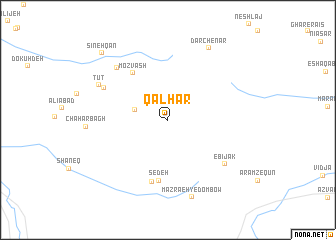
Qālhar (Eşfahān, Iran)Qālhar is a town in the Eşfahān region of Iran. An overview map of the region around Qālhar is displayed below.
regional and 3d topo map of Qālhar, Iran ::
Qālhar airports ::
The nearest airport is THR - Teheran Mehrabad Intl, located 201.3 km north of Qālhar.
Other airports nearby include QMJ - Masjed Soleiman Shahid Asyaee (264.5 km south west), Nearby towns ::
Darb-e Jūqā (3.3km west) //
Mozvash (6.2km north west) //
Sedeh (6.8km south) //
Kūchīlīs (7.1km south) //
Tūtrū (7.0km north west) //
Ebījak (7.3km south east) //
Dow Zīā (7.5km north west) //
Tūt (7.5km north west) //
Mazra‘eh-ye Dombow (8.9km south) //
Dar Chenār (8.9km north east) //
Sīnehqān (9.7km north west) //
[all distances 'as the bird flies' and approximate]  Places with similar names to Qālhar, Iran ::
Disclaimer :: Information on this page comes without warranty of any kind |
||
|
Where is Qālhar? Elevation and coordinates ::
Latitude (lat): 33°53'40"N Longitude (lon): 50°59'33"E
Elevation (approx.): 2333m (map arrows pan, magnifying glasses zoom) |
||
|
Visiting Qālhar? Hotel/Accommodation ::
Book a hotel in Qālhar Travel Guide ::
Buy a travel guide for Iran rental cars ::
car rental offers GPS waypoint ::
download a GPX waypoint (PoI) of Qālhar for your GPS receiver
|
||