|
search place name
|
||
Qameshlū (Iran)Qameshlū is a town in Iran. An overview map of the region around Qameshlū is displayed below.
regional and 3d topo map of Qameshlū, Iran ::

Qameshlū airports ::
The nearest airport is SDG - Sanandaj, located 155.1 km south west of Qameshlū.
Other airports nearby include RAS - Rasht (174.0 km north east), KSH - Bakhtaran Shahid Ashrafi Esfahani (226.2 km south west), Nearby towns ::
Gūrān (3.7km north) //
Cherāgh Mazra‘eh (4.0km north) //
Ūch Bolāgh (3.5km south east) //
Shīrīn Darreh (4.8km north east) //
Ūshtānīān (5.8km south) //
Āq Bolāgh-e Pā'īn (4.9km east) //
Abdāllar (6.3km south east) //
Sarīn Darreh (5.8km north east) //
Qāderlū (6.0km west) //
Ebdāl Lar (7.1km south east) //
Bahman (7.0km south west) //
Sang Deh (8.0km south) //
Chūkhūr Yūrd (7.2km south east) //
Khān Aḩmad-e Ḩeşārī (8.2km north east) //
Emāmzādeh Ḩamdollah (8.7km north east) //
Qolqātī (9.5km north west) //
[all distances 'as the bird flies' and approximate] 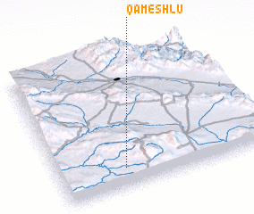 Places with similar names to Qameshlū, Iran ::
Disclaimer :: Information on this page comes without warranty of any kind |
||
|
Where is Qameshlū? Elevation and coordinates ::
Latitude (lat): 36°9'0"N Longitude (lon): 48°19'0"E
Elevation (approx.): 1936m (map arrows pan, magnifying glasses zoom) |
||
|
Visiting Qameshlū? Hotel/Accommodation ::
Book a hotel in Qameshlū Travel Guide ::
Buy a travel guide for Iran rental cars ::
car rental offers GPS waypoint ::
download a GPX waypoint (PoI) of Qameshlū for your GPS receiver
|
||