|
search place name
|
||
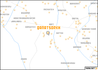
Qanāt Sorkh (Kermān, Iran)Qanāt Sorkh is a town in the Kermān region of Iran. An overview map of the region around Qanāt Sorkh is displayed below.
regional and 3d topo map of Qanāt Sorkh, Iran ::
Qanāt Sorkh airports ::
The nearest airport is KER - Kerman, located 123.2 km north of Qanāt Sorkh.
Other airports nearby include BND - Bandar Abbass Intl (221.5 km south), Nearby towns ::
Ḩājjīābād (1.0km north east) //
Hengū'īyeh (1.6km west) //
‘Abbāsābād (2.1km south east) //
Amīrābād (1.9km west) //
Karīmābād (2.1km west) //
Kāz̧emābād (2.5km south) //
Gorgshān (3.1km south) //
Bāft (3.2km north) //
Docheshmī (3.3km south) //
Gerīghān (3.4km south east) //
Sefteh (3.8km east) //
Hashtādtū'īyeh (4.5km south) //
Morsārū'īyeh (4.9km south east) //
Ḩasanābād (5.7km south east) //
Dowlatābād (6.0km north west) //
Shūrbāz (5.8km east) //
Istgāh-e Eşlāḩ-e Nezhād va Parvaresh-e Boz-e Korkī (6.5km north west) //
Gorgū'īyeh (6.4km west) //
Gowd Sorkh (7.1km south east) //
Ghālebābād (6.5km east) //
Deh Lāleh (6.9km east) //
Razkū'īyeh (8.6km north) //
Deh Lāleh-ye Pā'īn (7.6km east) //
Pīrū'īyeh (9.5km north east) //
Bāgh Fatk (9.8km north east) //
Bīdgarān (10.5km north west) //
[all distances 'as the bird flies' and approximate]  Places with similar names to Qanāt Sorkh, Iran ::
Disclaimer :: Information on this page comes without warranty of any kind |
||
|
Where is Qanāt Sorkh? Elevation and coordinates ::
Latitude (lat): 29°12'26"N Longitude (lon): 56°35'47"E
Elevation (approx.): 2212m (map arrows pan, magnifying glasses zoom) |
||
|
Visiting Qanāt Sorkh? Hotel/Accommodation ::
Book a hotel in Qanāt Sorkh Travel Guide ::
Buy a travel guide for Iran rental cars ::
car rental offers GPS waypoint ::
download a GPX waypoint (PoI) of Qanāt Sorkh for your GPS receiver
|
||