|
search place name
|
||
Qarah Qovīn (Ostān-e Kermānshāh, Iran)Qarah Qovīn is a town in the Ostān-e Kermānshāh region of Iran. An overview map of the region around Qarah Qovīn is displayed below.
regional and 3d topo map of Qarah Qovīn, Iran ::

Qarah Qovīn airports ::
The nearest airport is KSH - Bakhtaran Shahid Ashrafi Esfahani, located 11.6 km south of Qarah Qovīn.
Other airports nearby include SDG - Sanandaj (89.2 km north), Nearby towns ::
Kal Tarīn (0.5km west) //
Pīr Gheyb (2.8km north) //
Qīyah (2.8km south east) //
Ţāvīleh (3.8km south) //
Kenesht (4.3km north) //
Kūch Kaleh (3.7km north east) //
Balīn (3.7km south east) //
Gol Dasteh (3.8km west) //
Tīrandāzān (4.1km east) //
Do Cheshmeh (5.4km west) //
Seh Cheshmeh (5.8km west) //
Chenāreh (6.3km north west) //
Ţāq-e Bostān (7.2km south) //
Mānag Halāt (7.0km south east) //
Morād Ḩāşel (7.8km south) //
Tāzehābād (7.7km south) //
Melāvard (6.9km south west) //
Sorkheh Lījeh (8.0km south west) //
Fīrūzābād (9.6km south west) //
Khāneh-ye Khodā (9.1km north west) //
[all distances 'as the bird flies' and approximate] 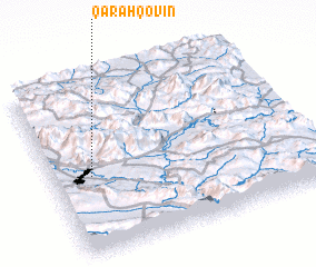 Places with similar names to Qarah Qovīn, Iran ::
Disclaimer :: Information on this page comes without warranty of any kind |
||
|
Where is Qarah Qovīn? Elevation and coordinates ::
Latitude (lat): 34°27'0"N Longitude (lon): 47°9'0"E
Elevation (approx.): 1481m (map arrows pan, magnifying glasses zoom) |
||
|
Visiting Qarah Qovīn? Hotel/Accommodation ::
Book a hotel in Qarah Qovīn Travel Guide ::
Buy a travel guide for Iran rental cars ::
car rental offers GPS waypoint ::
download a GPX waypoint (PoI) of Qarah Qovīn for your GPS receiver
|
||