|
search place name
|
||
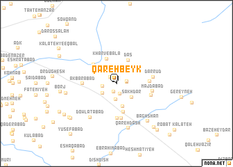
Qareh Beyk (Khorāsān, Iran)Qareh Beyk is a town in the Khorāsān region of Iran. An overview map of the region around Qareh Beyk is displayed below.
regional and 3d topo map of Qareh Beyk, Iran ::
Qareh Beyk airports ::
The nearest airport is ASB - Ashkhabad Ashgabat, located 215.0 km north of Qareh Beyk.
Nearby towns ::
Qareh Beyk (0.1km south east) //
Pīsh Forūsh (1.4km south) //
Bāgh-e Ershādīyeh (1.3km north west) //
Kalāteh-ye Solţānī (1.4km east) //
Qadamgāh (1.7km south) //
Khorombak (1.4km east) //
Khosrowābād-e Amīrī (1.9km west) //
Bāzeh Kalān (2.3km north west) //
Kārīz Now (2.6km south) //
Asadābād (2.4km south west) //
Sakhdar (3.0km south east) //
Sartalkh (3.8km south) //
Dās (4.0km north east) //
Kharv-e Bālā (4.1km north) //
Kārīz Now (4.6km south) //
Kharv-e Pā'īn (4.2km north west) //
Ja‘farābād (4.3km east) //
Akbarābād (4.4km west) //
Ḩājjīābād (5.6km south) //
Baghīsh (5.6km south) //
Majdābād (4.8km east) //
Ḩarīmābād (4.9km south east) //
Dar Rūd (4.9km east) //
Dowlatābād (6.4km south west) //
Qareh Dāsh (7.3km south) //
Bāghshan (7.3km south east) //
Borj (6.8km west) //
Hāshemābād (8.2km south west) //
Dāneh (8.6km south east) //
[all distances 'as the bird flies' and approximate] 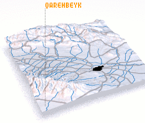 Places with similar names to Qareh Beyk, Iran ::
Disclaimer :: Information on this page comes without warranty of any kind |
||
|
Where is Qareh Beyk? Elevation and coordinates ::
Latitude (lat): 36°8'1"N Longitude (lon): 59°3'58"E
Elevation (approx.): 1426m (map arrows pan, magnifying glasses zoom) |
||
|
Visiting Qareh Beyk? Hotel/Accommodation ::
Book a hotel in Qareh Beyk Travel Guide ::
Buy a travel guide for Iran rental cars ::
car rental offers GPS waypoint ::
download a GPX waypoint (PoI) of Qareh Beyk for your GPS receiver
|
||