|
search place name
|
||
Qāsemābād (Khūzestān, Iran)Qāsemābād is a town in the Khūzestān region of Iran. An overview map of the region around Qāsemābād is displayed below.
regional and 3d topo map of Qāsemābād, Iran ::

Qāsemābād airports ::
The nearest airport is QMJ - Masjed Soleiman Shahid Asyaee, located 28.3 km south west of Qāsemābād.
Other airports nearby include AWZ - Ahwaz (115.5 km south west), MRX - Bandar Mahshahr Mahshahr (181.6 km south), ABD - Abadan (233.0 km south west), BSR - Basrah Intl (250.5 km south west), Nearby towns ::
Pīreh Loreh (0.0km north) //
Savārābād (0.5km north) //
Jalīlābād-e Sar Mūrd (1.8km south east) //
Boneh-ye Majīd (1.6km west) //
Māshgīrī (1.6km west) //
Gūteh Kalāt (1.7km east) //
Āb Chahrū (2.1km south east) //
Rostamābād (2.4km north) //
Darreh Qal‘eh (2.4km south west) //
Shahrak-e Abūzār (2.4km south west) //
Chegārmān (2.7km north) //
Deh-e Mūn (2.4km south west) //
Qal‘eh Lūt (2.9km south west) //
Savārābād (2.8km east) //
Karīmābād (3.1km north west) //
Bāpīr-e Ja‘far Qolī (3.1km west) //
Chegārmān-e Gholāmḩoseyn (3.7km north) //
Āb-e Chahrū (3.7km south) //
Fatḩābād (3.9km north) //
Mūshgīrī (3.6km north west) //
Chogārmān (4.0km north west) //
Shahīd Kheyrollāh-e Nazarpūr (4.0km south west) //
Boneh-ye Nīāz ‘Alī (3.9km south west) //
Karīmābād (4.4km north) //
Ḩamzeh ‘Alī (4.0km south east) //
Qāsemābād-e Dīneh Rāk (4.5km north) //
Qal‘eh Bardī (4.2km east) //
Baneh Doshī (5.0km south) //
Āb Zehlū (4.9km north west) //
[all distances 'as the bird flies' and approximate] 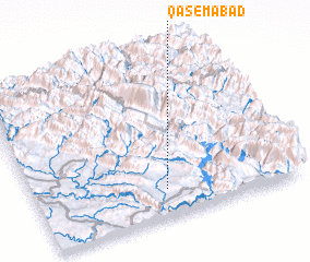 Places with similar names to Qāsemābād, Iran ::
// Kazımabad (AZ)
// Kāsimābād (IN)
// Kāz̧emābād (IR)
// Kāz̧emābād (IR)
// Kāz̧emābād (IR)
// Kāz̧emābād (IR)
// Kāz̧emābād (IR)
// Kāz̧emābād (IR)
// Kāz̧emābād (IR)
// Kāz̧emābād (IR)
Disclaimer :: Information on this page comes without warranty of any kind |
||
|
Where is Qāsemābād? Elevation and coordinates ::
Latitude (lat): 32°10'0"N Longitude (lon): 49°30'0"E
Elevation (approx.): 709m (map arrows pan, magnifying glasses zoom) |
||
|
Visiting Qāsemābād? Hotel/Accommodation ::
Book a hotel in Qāsemābād Travel Guide ::
Buy a travel guide for Iran rental cars ::
car rental offers GPS waypoint ::
download a GPX waypoint (PoI) of Qāsemābād for your GPS receiver
|
||