|
search place name
|
||
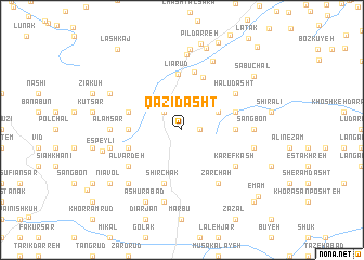
Qāẕī Dasht (Gīlān, Iran)Qāẕī Dasht is a town in the Gīlān region of Iran. An overview map of the region around Qāẕī Dasht is displayed below.
regional and 3d topo map of Qāẕī Dasht, Iran ::
Qāẕī Dasht airports ::
The nearest airport is RAS - Rasht, located 56.4 km north west of Qāẕī Dasht.
Other airports nearby include RZR - Ramsar (57.7 km east), THR - Teheran Mehrabad Intl (181.1 km south east), Nearby towns ::
Sūtī Sarā (1.5km east) //
Fī Āb (2.4km north west) //
Mīān Lengeh (3.5km north east) //
Sangbon (4.4km east) //
Sīāh Āb (4.4km west) //
Tārīk Sarā (4.4km west) //
Līārūd (5.8km north) //
Ābgarm Rūd (5.7km north) //
Shīr Chāk (5.8km south) //
Amīrjān (4.8km north east) //
Lashā Kūh (4.8km north west) //
Palā Gardan (4.8km south west) //
Chanbal Dasht (4.8km south west) //
Lārneh (4.8km south west) //
Changūl (6.1km north) //
Halū Dasht (5.8km north east) //
Karefkash (5.8km south east) //
Alvardeh (5.8km south west) //
Zarchāh (6.3km south east) //
Katīm (5.9km west) //
‘Alam Sar (5.9km west) //
Sangbon (5.9km east) //
Sīāhkhūnī (6.2km west) //
Shīyeh (7.6km south) //
Arbūr Dasht (6.2km east) //
Sarleyl (7.7km north) //
Āghūzchāl (7.5km north) //
Seyyed Sarā (7.1km south west) //
Khoshk Sāmī (7.1km south west) //
[all distances 'as the bird flies' and approximate] 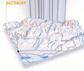 Places with similar names to Qāẕī Dasht, Iran ::
// Coste Chaude (FR)
Disclaimer :: Information on this page comes without warranty of any kind |
||
|
Where is Qāẕī Dasht? Elevation and coordinates ::
Latitude (lat): 36°57'0"N Longitude (lon): 50°2'0"E
Elevation (approx.): 1586m (map arrows pan, magnifying glasses zoom) |
||
|
Visiting Qāẕī Dasht? Hotel/Accommodation ::
Book a hotel in Qāẕī Dasht Travel Guide ::
Buy a travel guide for Iran rental cars ::
car rental offers GPS waypoint ::
download a GPX waypoint (PoI) of Qāẕī Dasht for your GPS receiver
|
||