|
search place name
|
||
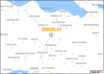
Qom Qal‘eh (Ostān-e Āz̄arbāyjān-e Sharqī, Iran)Qom Qal‘eh is a town in the Ostān-e Āz̄arbāyjān-e Sharqī region of Iran. An overview map of the region around Qom Qal‘eh is displayed below.
regional and 3d topo map of Qom Qal‘eh, Iran ::
Qom Qal‘eh airports ::
The nearest airport is TBZ - Tabriz Intl, located 145.2 km north of Qom Qal‘eh.
Other airports nearby include SDG - Sanandaj (212.3 km south east), Nearby towns ::
Qareh Khān (1.2km south) //
Gowg Tappeh (2.4km east) //
Laj (3.0km north) //
Andarqāsh (4.2km south) //
Dāreh Lak (4.0km north west) //
Garīfāsh (4.7km south west) //
Ḩājjī Khvosh (4.7km north east) //
Ja‘farābād (5.1km south west) //
Torshakān (5.2km north east) //
Kīchābād (6.1km north) //
Deryāz (5.3km west) //
Kābāzaleh (6.7km north) //
Tekānlūjeh (6.8km south east) //
Gāpīs (7.1km north west) //
Yūsof Kand (7.3km south) //
Dūst ‘Alī (7.9km south) //
Khāneqāh (8.0km south west) //
Qezel Qapī (8.0km north west) //
Bābā ‘Alī (8.8km north east) //
Gerdeh Gerow (8.9km north east) //
Khātūn Bāgh (8.5km south east) //
[all distances 'as the bird flies' and approximate] 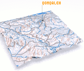 Places with similar names to Qom Qal‘eh, Iran ::
Disclaimer :: Information on this page comes without warranty of any kind |
||
|
Where is Qom Qal‘eh? Elevation and coordinates ::
Latitude (lat): 36°52'37"N Longitude (lon): 45°46'41"E
Elevation (approx.): 1295m (map arrows pan, magnifying glasses zoom) |
||
|
Visiting Qom Qal‘eh? Hotel/Accommodation ::
Book a hotel in Qom Qal‘eh Travel Guide ::
Buy a travel guide for Iran rental cars ::
car rental offers GPS waypoint ::
download a GPX waypoint (PoI) of Qom Qal‘eh for your GPS receiver
|
||