|
search place name
|
||
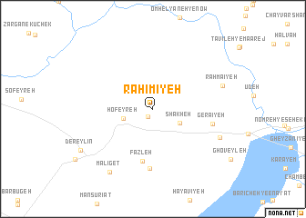
Raḩīmīyeh (Khūzestān, Iran)Raḩīmīyeh is a town in the Khūzestān region of Iran. An overview map of the region around Raḩīmīyeh is displayed below.
regional and 3d topo map of Raḩīmīyeh, Iran ::
Raḩīmīyeh airports ::
The nearest airport is AWZ - Ahwaz, located 25.9 km west of Raḩīmīyeh.
Other airports nearby include MRX - Bandar Mahshahr Mahshahr (79.7 km south), QMJ - Masjed Soleiman Shahid Asyaee (85.0 km north), ABD - Abadan (124.8 km south west), BSR - Basrah Intl (152.2 km south west), Nearby towns ::
Raḩmānīyeh (1.0km south west) //
Shākheh (3.3km south east) //
Ḩofeyreh (3.3km west) //
Faẕleh (6.5km south) //
Maqām-e Ḩazneh (7.3km south) //
Gerā'īyeh (6.5km east) //
Beyūẕ (7.8km south east) //
Raḩmā'īyeh (7.9km east) //
Malīget (9.0km south west) //
Dereylīn (9.1km south west) //
[all distances 'as the bird flies' and approximate] 
Disclaimer :: Information on this page comes without warranty of any kind |
||
|
Where is Raḩīmīyeh? Elevation and coordinates ::
Latitude (lat): 31°15'57"N Longitude (lon): 49°1'14"E
Elevation (approx.): 27m (map arrows pan, magnifying glasses zoom) |
||
|
Visiting Raḩīmīyeh? Hotel/Accommodation ::
Book a hotel in Raḩīmīyeh Travel Guide ::
Buy a travel guide for Iran rental cars ::
car rental offers GPS waypoint ::
download a GPX waypoint (PoI) of Raḩīmīyeh for your GPS receiver
|
||