|
search place name
|
||
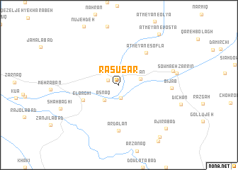
Rāsūsar (Ostān-e Āz̄arbāyjān-e Sharqī, Iran)Rāsūsar is a town in the Ostān-e Āz̄arbāyjān-e Sharqī region of Iran. An overview map of the region around Rāsūsar is displayed below.
regional and 3d topo map of Rāsūsar, Iran ::
Rāsūsar airports ::
The nearest airport is TBZ - Tabriz Intl, located 86.3 km west of Rāsūsar.
Nearby towns ::
Barāghūsh (1.5km north west) //
Qeyşaraq (2.1km south) //
Asnaq (3.0km south west) //
Ālān (2.9km east) //
E'lbāghī (5.1km south west) //
Ātmeyān-e Soflá (6.1km north east) //
Ardalān (7.2km south) //
Bījāb (6.6km east) //
Qezeljeh-ye Sādāt (7.0km east) //
Ajīrābād (9.0km south east) //
Ātmeyān-e Vosţá (9.4km north east) //
Denīgeh Tappeh (9.6km south east) //
Dīzaj-e Shūr (10.1km south east) //
[all distances 'as the bird flies' and approximate] 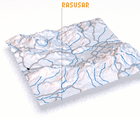 Places with similar names to Rāsūsar, Iran ::
// Roosisaare (EE)
Disclaimer :: Information on this page comes without warranty of any kind |
||
|
Where is Rāsūsar? Elevation and coordinates ::
Latitude (lat): 38°5'0"N Longitude (lon): 47°13'0"E
Elevation (approx.): 1689m (map arrows pan, magnifying glasses zoom) |
||
|
Visiting Rāsūsar? Hotel/Accommodation ::
Book a hotel in Rāsūsar Travel Guide ::
Buy a travel guide for Iran rental cars ::
car rental offers GPS waypoint ::
download a GPX waypoint (PoI) of Rāsūsar for your GPS receiver
|
||