|
search place name
|
||
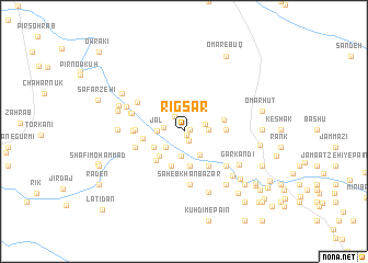
Rīg Sar (Sīstān va Balūchestān, Iran)Rīg Sar is a town in the Sīstān va Balūchestān region of Iran. An overview map of the region around Rīg Sar is displayed below.
regional and 3d topo map of Rīg Sar, Iran ::
Rīg Sar airports ::
The nearest airport is ZBR - Chah Bahar, located 67.2 km west of Rīg Sar.
Other airports nearby include GWD - Gwadar (140.4 km east), Nearby towns ::
Lāynārī (0.5km south east) //
Degrū (0.6km east) //
Kārānī (1.0km south east) //
Jangārak (1.7km north west) //
Bīlīngī (1.9km west) //
Dīyūl (2.1km east) //
Banārū (2.3km south west) //
Morīdvārū Pā'īn (2.2km east) //
Faqīrzī (2.5km south) //
Jal (2.5km west) //
‘Arab Zehī (2.8km south east) //
Owra'ī (3.3km south west) //
Dokū (3.2km south west) //
Karīm Bakhsh Bāzār (3.6km south) //
Lāl Moḩammad Bāzār (3.6km south) //
Morād Moḩammad Bāzār (3.7km south) //
Rūkū (3.9km south west) //
Morīdvārū Bālā (3.8km east) //
Beryānī (3.8km west) //
Jūkat (4.2km south east) //
Nūrā Bāzār (4.2km south east) //
Seyyed Bārān (3.9km east) //
Sāyānī (4.5km west) //
Band Sar (4.8km west) //
Chūtānī (4.7km west) //
Şāḩebkhān Bāzār (5.4km south) //
Band Sar (5.3km south east) //
Ḩoseyn Zehī (5.2km north west) //
Sīnāchū (5.1km west) //
[all distances 'as the bird flies' and approximate] 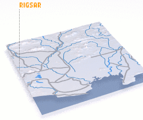 Places with similar names to Rīg Sar, Iran ::
Disclaimer :: Information on this page comes without warranty of any kind |
||
|
Where is Rīg Sar? Elevation and coordinates ::
Latitude (lat): 25°38'54"N Longitude (lon): 61°0'40"E
Elevation (approx.): 37m (map arrows pan, magnifying glasses zoom) |
||
|
Visiting Rīg Sar? Hotel/Accommodation ::
Book a hotel in Rīg Sar Travel Guide ::
Buy a travel guide for Iran rental cars ::
car rental offers GPS waypoint ::
download a GPX waypoint (PoI) of Rīg Sar for your GPS receiver
|
||