|
search place name
|
||
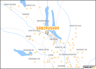
Sabz Pūshān (Kermān, Iran)Sabz Pūshān is a town in the Kermān region of Iran. An overview map of the region around Sabz Pūshān is displayed below.
regional and 3d topo map of Sabz Pūshān, Iran ::
Sabz Pūshān airports ::
The nearest airport is KER - Kerman, located 191.6 km north of Sabz Pūshān.
Other airports nearby include BND - Bandar Abbass Intl (208.5 km south west), Nearby towns ::
Rah Kord (0.9km east) //
Kahīrū (1.8km south west) //
‘Alīābād (2.0km north east) //
Sabzvārān (2.6km south east) //
Āhevān (2.9km west) //
Behjerd-e Bālā (2.9km west) //
Behjerd-e Pā'īn (3.1km west) //
Kalarūd (3.6km south east) //
Ḩoseynābād (3.9km south east) //
Malekābād (4.3km south east) //
Band-e Sarājī (4.5km north) //
‘Enāyatābād (4.5km west) //
Kālāghābād (4.7km south east) //
Qal‘eh Now (5.2km south east) //
Hūkerd (6.3km south) //
‘Alīābād (5.7km west) //
Sarjāz (6.3km south east) //
‘Abdolābād (7.1km south) //
Galūmārān (6.3km west) //
Ḩoseynābād-e Nakhlī (6.3km west) //
Ebrāhīmābād (7.3km south) //
Moḩammadābād (7.3km south) //
Deh-e Sheykh (7.4km south east) //
Mārān (6.8km west) //
Posht-e Lor (7.5km south east) //
Bīzhanābād (7.9km south west) //
Allāhābād (8.3km south west) //
Ţowhān (7.8km south east) //
Kahnūj-e Tīrābād (9.1km south) //
[all distances 'as the bird flies' and approximate] 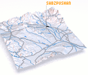 Places with similar names to Sabz Pūshān, Iran ::
// Sabz Pūshān (IR)
// Sabz Pūshān (IR)
Disclaimer :: Information on this page comes without warranty of any kind |
||
|
Where is Sabz Pūshān? Elevation and coordinates ::
Latitude (lat): 28°40'47"N Longitude (lon): 57°42'47"E
Elevation (approx.): 718m (map arrows pan, magnifying glasses zoom) |
||
|
Visiting Sabz Pūshān? Hotel/Accommodation ::
Book a hotel in Sabz Pūshān Travel Guide ::
Buy a travel guide for Iran rental cars ::
car rental offers GPS waypoint ::
download a GPX waypoint (PoI) of Sabz Pūshān for your GPS receiver
|
||