|
search place name
|
||
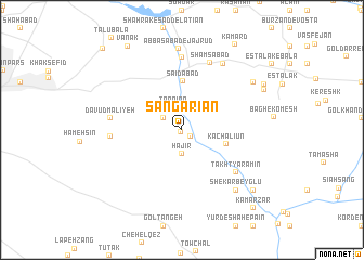
Sangarīān (Tehrān, Iran)Sangarīān is a town in the Tehrān region of Iran. An overview map of the region around Sangarīān is displayed below.
regional and 3d topo map of Sangarīān, Iran ::
Sangarīān airports ::
The nearest airport is THR - Teheran Mehrabad Intl, located 35.0 km west of Sangarīān.
Other airports nearby include RZR - Ramsar (163.6 km north west), Nearby towns ::
Sangareyūn (0.2km south) //
Khojīr (1.0km south east) //
Tarqīūn-e Dovvom (1.9km north west) //
Tarqīān (2.4km north) //
Tarqīān (2.4km north) //
Ḩajīr (2.5km south) //
Kachalīūn (4.0km east) //
Sa‘īdābād (5.0km north) //
Takht Yāramīn (6.3km south east) //
Cheshmeh-ye Hāshemkhānī (6.1km west) //
Khosrowābād (7.4km north) //
Shamsābād (7.3km north) //
Dāvūd Mālīyeh (6.1km west) //
Manūchehrābād (7.7km north east) //
Shekar Beyglū (7.7km south east) //
‘Abbāsābād-e Jājrūd (8.3km north) //
Khorram Dasht (7.8km north east) //
Sīāh Sang (8.0km north east) //
Eşţalak-e Vasaţ (8.3km north east) //
Khūkdānī (8.7km south east) //
Vanak (9.7km north west) //
Kamard (9.8km north east) //
Kamar Zar (10.1km south east) //
Talū Pā'īn (10.7km north west) //
[all distances 'as the bird flies' and approximate] 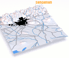 Places with similar names to Sangarīān, Iran ::
// Xınnakirǝn (AZ)
// Šena Krena (BA)
// Sîncrăieni (RO)
// Singureni (RO)
// Sangarrén (ES)
// Sangreña (ES)
// Zancarrón (ES)
// Soaniakarana (MG)
// Singareni (IN)
// Singran (IN)
Disclaimer :: Information on this page comes without warranty of any kind |
||
|
Where is Sangarīān? Elevation and coordinates ::
Latitude (lat): 35°41'21"N Longitude (lon): 51°42'0"E
Elevation (approx.): 1392m (map arrows pan, magnifying glasses zoom) |
||
|
Visiting Sangarīān? Hotel/Accommodation ::
Book a hotel in Sangarīān Travel Guide ::
Buy a travel guide for Iran rental cars ::
car rental offers GPS waypoint ::
download a GPX waypoint (PoI) of Sangarīān for your GPS receiver
|
||