|
search place name
|
||
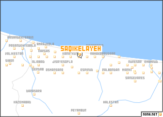
Sāqīkelāyeh (Iran)Sāqīkelāyeh is a town in Iran. An overview map of the region around Sāqīkelāyeh is displayed below.
regional and 3d topo map of Sāqīkelāyeh, Iran ::
Sāqīkelāyeh airports ::
The nearest airport is RZR - Ramsar, located 52.5 km north west of Sāqīkelāyeh.
Other airports nearby include THR - Teheran Mehrabad Intl (112.2 km south), RAS - Rasht (158.5 km north west), Nearby towns ::
Aşgharābād (0.6km north west) //
Tīl Rūdsar (1.1km east) //
Gorjī Sarā (2.0km west) //
Karātkūtī (2.0km west) //
Dānīāl (2.7km south west) //
Golūr-e Bālā (2.5km east) //
Jamshīdābād (2.9km north west) //
Tīleh Kenār (3.4km south) //
Nārenj Bandben (3.4km south) //
Varbon (3.4km south) //
Espī Rūd (3.5km south) //
Tāzehābād (3.1km north west) //
Sīsarā Pā'īn (3.3km north east) //
Salāmat Sarā (3.4km west) //
Jīsā-ye Soflá (3.7km south west) //
Chārez (4.1km south east) //
Namak Ābrūd Sar (4.0km east) //
Jīsā-ye ‘Olyā (4.8km south west) //
Chārī (4.8km south west) //
Jīsā (5.2km south east) //
Khoshk Kolā (4.9km west) //
Asbchīn (5.0km west) //
‘Os̄mān Sarā (5.9km south west) //
Khvoshāmīān (5.7km east) //
Pālbandān (6.4km south east) //
Ţālesh Kheyl (6.4km west) //
Amraj Kolā (7.0km west) //
Kargās (6.9km west) //
Kīā Deh (7.0km east) //
[all distances 'as the bird flies' and approximate]  Places with similar names to Sāqīkelāyeh, Iran ::
// Xoquicoaloya (MX)
Disclaimer :: Information on this page comes without warranty of any kind |
||
|
Where is Sāqīkelāyeh? Elevation and coordinates ::
Latitude (lat): 36°41'49"N Longitude (lon): 51°12'18"E
(map arrows pan, magnifying glasses zoom) |
||
|
Visiting Sāqīkelāyeh? Hotel/Accommodation ::
Book a hotel in Sāqīkelāyeh Travel Guide ::
Buy a travel guide for Iran rental cars ::
car rental offers GPS waypoint ::
download a GPX waypoint (PoI) of Sāqīkelāyeh for your GPS receiver
|
||