|
search place name
|
||
Sarangāv (Ostān-e Kohgīlūyeh va Būyer Aḩmad, Iran)Sarangāv is a town in the Ostān-e Kohgīlūyeh va Būyer Aḩmad region of Iran. An overview map of the region around Sarangāv is displayed below.
regional and 3d topo map of Sarangāv, Iran ::

Sarangāv airports ::
The nearest airport is MRX - Bandar Mahshahr Mahshahr, located 107.7 km south west of Sarangāv.
Other airports nearby include QMJ - Masjed Soleiman Shahid Asyaee (118.0 km north west), AWZ - Ahwaz (122.6 km west), ABD - Abadan (193.7 km south west), Nearby towns ::
Larmān (0.8km north west) //
Gach Gerd (1.4km south east) //
Boneh Pīr (2.2km east) //
Kārūn (2.6km north west) //
Kalārān (2.9km north west) //
Barm-e Sīāh (3.3km north west) //
Būrbādī (3.5km north west) //
Mūngīrah (3.4km south east) //
Dalī Chāh Zālū (4.2km south east) //
Rekī (4.3km north west) //
Seyyed Şāleḩ (5.7km north west) //
Tortāb-e Ḩajjīābād (7.0km south west) //
Galeh Rūdbardeh (8.3km north) //
Darreh Bīd (8.0km south east) //
Sar Tortāb-e Ḩājjīābād (8.0km south west) //
[all distances 'as the bird flies' and approximate] 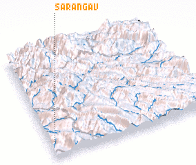 Places with similar names to Sarangāv, Iran ::
Disclaimer :: Information on this page comes without warranty of any kind |
||
|
Where is Sarangāv? Elevation and coordinates ::
Latitude (lat): 31°9'41"N Longitude (lon): 50°1'58"E
Elevation (approx.): 964m (map arrows pan, magnifying glasses zoom) |
||
|
Visiting Sarangāv? Hotel/Accommodation ::
Book a hotel in Sarangāv Travel Guide ::
Buy a travel guide for Iran rental cars ::
car rental offers GPS waypoint ::
download a GPX waypoint (PoI) of Sarangāv for your GPS receiver
|
||