|
search place name
|
||
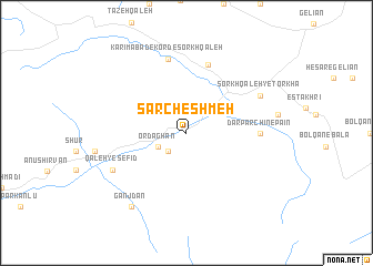
Sar Cheshmeh (Khorāsān, Iran)Sar Cheshmeh is a town in the Khorāsān region of Iran. An overview map of the region around Sar Cheshmeh is displayed below.
regional and 3d topo map of Sar Cheshmeh, Iran ::
Sar Cheshmeh airports ::
The nearest airport is ASB - Ashkhabad Ashgabat, located 108.3 km north east of Sar Cheshmeh.
Nearby towns ::
Ḩasanābād (2.4km south west) //
Bīdvāz (2.4km south west) //
Ordaghān (2.7km south west) //
Sorkh Qal‘eh-ye Kordhā (7.0km north) //
Dar Parchīn-e Pā'īn (5.9km east) //
Karīmābād-e Kord-e Sorkh Qal‘eh (7.6km north) //
Golīān (7.6km north) //
Sorkh Qal‘eh-ye Torkhā (7.0km north east) //
Qal‘eh-ye Sefīd (7.0km south west) //
Ganjdān (8.6km south west) //
[all distances 'as the bird flies' and approximate] 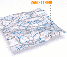 Places with similar names to Sar Cheshmeh, Iran ::
// Sarychashma (UZ)
// Sar Cheshmeh (IR)
// Sar Cheshmeh (IR)
// Sar Cheshmeh (IR)
// Sar Cheshmeh (IR)
// Sar Cheshmeh (IR)
// Sar Cheshmeh (IR)
// Sar Cheshmeh (IR)
// Sar Cheshmeh (IR)
// Sar Cheshmeh (IR)
Disclaimer :: Information on this page comes without warranty of any kind |
||
|
Where is Sar Cheshmeh? Elevation and coordinates ::
Latitude (lat): 37°8'0"N Longitude (lon): 57°46'0"E
Elevation (approx.): 1728m (map arrows pan, magnifying glasses zoom) |
||
|
Visiting Sar Cheshmeh? Hotel/Accommodation ::
Book a hotel in Sar Cheshmeh Travel Guide ::
Buy a travel guide for Iran rental cars ::
car rental offers GPS waypoint ::
download a GPX waypoint (PoI) of Sar Cheshmeh for your GPS receiver
|
||