|
search place name
|
||
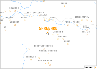
Sar-e Bard (Khūzestān, Iran)Sar-e Bard is a town in the Khūzestān region of Iran. An overview map of the region around Sar-e Bard is displayed below.
regional and 3d topo map of Sar-e Bard, Iran ::
Sar-e Bard airports ::
The nearest airport is QMJ - Masjed Soleiman Shahid Asyaee, located 93.5 km south of Sar-e Bard.
Other airports nearby include AWZ - Ahwaz (168.9 km south), KSH - Bakhtaran Shahid Ashrafi Esfahani (246.2 km north west), Nearby towns ::
Lokelā (1.9km north) //
Galleh Gonjān (1.6km east) //
Chāl Mīrūn (3.1km east) //
Darreh-ye Darvīsh Mordeh (3.6km south east) //
Polchī (5.6km north) //
Chovāb (5.7km north) //
Kūl Sīrāb (5.0km east) //
Tūshk (5.8km north) //
Dārmodī (5.8km north) //
Markī-ye Ḩātamvand (5.8km south) //
Rādez (5.9km north) //
Jel Kūh (6.6km north) //
Markī-ye Ja‘farvand (7.4km south) //
Labāb (7.2km south east) //
Chāl Ţellā (8.0km north west) //
Fīlāb (7.2km north east) //
Bard-e Gūrī (8.4km south west) //
Garm (8.9km north west) //
Fīlā (9.7km north west) //
Chāl Revegeh (9.7km north west) //
[all distances 'as the bird flies' and approximate] 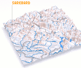 Places with similar names to Sar-e Bard, Iran ::
// São Roberto (BR)
// São Roberto (BR)
// Srebroto (BG)
// Sribordi (BD)
// Sarāb Rūd (IR)
// Sarbard (IR)
// São Roberto (BR)
// Ceroborta (MD)
// Xar Burd (CN)
// Sare Baradi (GW)
Disclaimer :: Information on this page comes without warranty of any kind |
||
|
Where is Sar-e Bard? Elevation and coordinates ::
Latitude (lat): 32°50'0"N Longitude (lon): 49°6'0"E
Elevation (approx.): 1218m (map arrows pan, magnifying glasses zoom) |
||
|
Visiting Sar-e Bard? Hotel/Accommodation ::
Book a hotel in Sar-e Bard Travel Guide ::
Buy a travel guide for Iran rental cars ::
car rental offers GPS waypoint ::
download a GPX waypoint (PoI) of Sar-e Bard for your GPS receiver
|
||