|
search place name
|
||
Sar-e Sham (Hormozgān, Iran)Sar-e Sham is a town in the Hormozgān region of Iran. An overview map of the region around Sar-e Sham is displayed below.
regional and 3d topo map of Sar-e Sham, Iran ::

Sar-e Sham airports ::
The nearest airport is KHS - Khasab, located 133.1 km west of Sar-e Sham.
Other airports nearby include BND - Bandar Abbass Intl (147.2 km north west), RKT - Ras Al Khaimah Intl (183.3 km south west), FJR - Fujeirah Fujairah Intl (188.6 km south west), Nearby towns ::
Pīsh Bārīk (1.5km west) //
Tabakī (2.7km south west) //
Deh Bandān (3.0km south east) //
Darjag (4.4km south) //
Barāheng (5.1km north) //
Kashmagī (5.1km south) //
Kūh-e Ḩeydar (5.0km west) //
Raven (7.2km east) //
[all distances 'as the bird flies' and approximate] 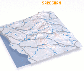 Places with similar names to Sar-e Sham, Iran ::
Disclaimer :: Information on this page comes without warranty of any kind |
||
|
Where is Sar-e Sham? Elevation and coordinates ::
Latitude (lat): 26°24'15"N Longitude (lon): 57°32'52"E
Elevation (approx.): 611m (map arrows pan, magnifying glasses zoom) |
||
|
Visiting Sar-e Sham? Hotel/Accommodation ::
Book a hotel in Sar-e Sham Travel Guide ::
Buy a travel guide for Iran rental cars ::
car rental offers GPS waypoint ::
download a GPX waypoint (PoI) of Sar-e Sham for your GPS receiver
|
||