|
search place name
|
||
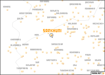
Sar Khūnī (Eşfahān, Iran)Sar Khūnī is a town in the Eşfahān region of Iran. An overview map of the region around Sar Khūnī is displayed below.
regional and 3d topo map of Sar Khūnī, Iran ::
Sar Khūnī airports ::
The nearest airport is AZD - Yazd Shahid Sadooghi, located 186.6 km south east of Sar Khūnī.
Nearby towns ::
Moḩammadābād (1.9km north west) //
Maḩmūdābād (2.4km north east) //
Zorūgī (2.8km north east) //
Ḩeydarābād (3.8km south) //
Sang-e Zebr (3.8km south east) //
Khārvān (3.8km north east) //
Shāh Kūh (4.1km east) //
Chegāygūn (5.3km south) //
Mārī (4.6km west) //
Ḩabībollāh (5.5km south) //
Qāsemābād (5.6km south) //
Kas̄īrābād (4.9km north east) //
Şāleḩābād (4.9km north east) //
Vandā'ī (5.7km south) //
Tīrābād (5.1km north east) //
Şafīābād (6.1km north) //
Shīrābād (5.9km south) //
Moḩammadābād (6.1km north) //
Kejān (5.7km north east) //
Ḩabībābād (6.1km north) //
Sharīfābād (6.0km south west) //
Shāh Kūh (5.3km east) //
Fakhrābād (5.9km north east) //
Gāleh Kajān (5.6km east) //
Kūlīān (6.5km north west) //
Jūyābād (5.9km east) //
Naşīrābād (6.4km east) //
Āshnān (7.6km north) //
Karīmābād (7.2km south west) //
[all distances 'as the bird flies' and approximate] 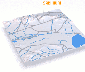 Places with similar names to Sar Khūnī, Iran ::
Disclaimer :: Information on this page comes without warranty of any kind |
||
|
Where is Sar Khūnī? Elevation and coordinates ::
Latitude (lat): 32°50'57"N Longitude (lon): 52°38'6"E
Elevation (approx.): 2671m (map arrows pan, magnifying glasses zoom) |
||
|
Visiting Sar Khūnī? Hotel/Accommodation ::
Book a hotel in Sar Khūnī Travel Guide ::
Buy a travel guide for Iran rental cars ::
car rental offers GPS waypoint ::
download a GPX waypoint (PoI) of Sar Khūnī for your GPS receiver
|
||