|
search place name
|
||
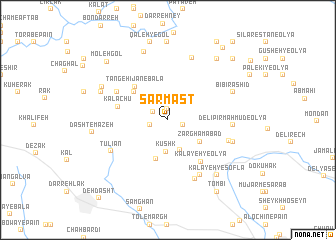
Sarmast (Ostān-e Kohgīlūyeh va Būyer Aḩmad, Iran)Sarmast is a town in the Ostān-e Kohgīlūyeh va Būyer Aḩmad region of Iran. An overview map of the region around Sarmast is displayed below.
regional and 3d topo map of Sarmast, Iran ::
Sarmast airports ::
The nearest airport is MRX - Bandar Mahshahr Mahshahr, located 146.3 km west of Sarmast.
Other airports nearby include QMJ - Masjed Soleiman Shahid Asyaee (180.3 km north west), AWZ - Ahwaz (185.9 km west), BUZ - Bushehr (214.5 km south), SYZ - Shiraz Shahid Dastghaib Intl (239.3 km south east), Nearby towns ::
Tang-e Sapū (1.3km north) //
Kūhzād (1.6km east) //
Bardal (1.6km north west) //
Khīār Kāleh (1.8km west) //
Kūshk (3.6km south) //
Eslāmābād (3.5km south) //
Gūrkhāneh (3.9km south east) //
Zarghāmābād (3.9km south east) //
Dastgerd (4.5km south) //
Eshkaft (4.5km north west) //
Tang-e Hījān-e Vostá (4.5km north west) //
Tang-e Kenār (4.5km north west) //
Tang-e Hījān-e Bālā (4.9km north west) //
Kalāchū (5.0km west) //
Kalāyeh-ye ‘Olyā (5.6km south east) //
Tang-e Hījān-e Pā'īn (5.8km north west) //
Garūbāz (5.8km north west) //
Kalāyeh-ye Āsīāb (6.9km south east) //
Delī Pīr Maḩmūd-e Soflá (6.3km east) //
Līr Tork (7.0km south) //
Tūlīān (6.5km south west) //
Delī Pīr Maḩmūd-e ‘Olyā (6.3km east) //
Sheykh Hābīl-e Vostá (7.3km north) //
Dam-e Tang-e Sūsan (6.7km east) //
Delī Pīr Maḩmūd-e Vostá (6.7km east) //
Bībī Rashīd (7.0km north east) //
Qal‘eh Dokhtar (7.9km north) //
Emāmzādeh Bībī Shahādat (7.2km north west) //
Kalāyeh-ye Soflá (7.7km south east) //
[all distances 'as the bird flies' and approximate] 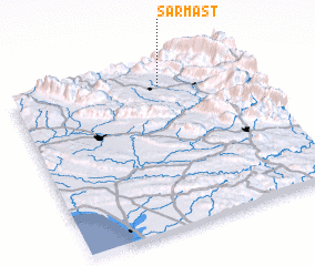 Places with similar names to Sarmast, Iran ::
// Sarmast (IR)
// Sarmast (IR)
// Sarmast (IR)
// Sar Mastī (IR)
// Sar Mazdeh (IR)
// Sarmast (PK)
// Seréméssadou (GN)
// Sarmast (PK)
Disclaimer :: Information on this page comes without warranty of any kind |
||
|
Where is Sarmast? Elevation and coordinates ::
Latitude (lat): 30°52'19"N Longitude (lon): 50°38'4"E
Elevation (approx.): 910m (map arrows pan, magnifying glasses zoom) |
||
|
Visiting Sarmast? Hotel/Accommodation ::
Book a hotel in Sarmast Travel Guide ::
Buy a travel guide for Iran rental cars ::
car rental offers GPS waypoint ::
download a GPX waypoint (PoI) of Sarmast for your GPS receiver
|
||