|
search place name
|
||
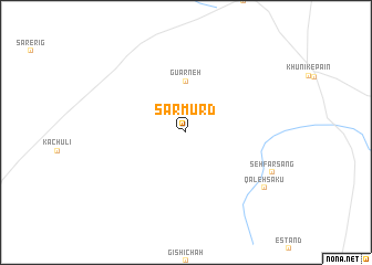
Sar Mūrd (Khūzestān, Iran)Sar Mūrd is a town in the Khūzestān region of Iran. An overview map of the region around Sar Mūrd is displayed below.
regional and 3d topo map of Sar Mūrd, Iran ::
Sar Mūrd airports ::
The nearest airport is XBJ - Birjand, located 177.7 km north of Sar Mūrd.
Other airports nearby include ZAH - Zahedan Intl (232.7 km south east), Nearby towns ::
Gūārneh (5.2km north) //
Seh Farsang (8.4km south east) //
Qal‘eh Sakū (8.8km south east) //
[all distances 'as the bird flies' and approximate] 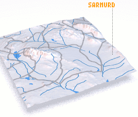 Places with similar names to Sar Mūrd, Iran ::
// Xramort (AZ)
// Cerro Morado (PA)
// Sarmörd (IQ)
// Sara Maradi (NE)
// Sūrmūrd (IR)
// Zahrā Mordeh (IR)
// Zāram Rūd (IR)
// Saramardou (GN)
// Surimorta (PG)
Disclaimer :: Information on this page comes without warranty of any kind |
||
|
Where is Sar Mūrd? Elevation and coordinates ::
Latitude (lat): 31°25'0"N Longitude (lon): 59°59'0"E
Elevation (approx.): 1438m (map arrows pan, magnifying glasses zoom) |
||
|
Visiting Sar Mūrd? Hotel/Accommodation ::
Book a hotel in Sar Mūrd Travel Guide ::
Buy a travel guide for Iran rental cars ::
car rental offers GPS waypoint ::
download a GPX waypoint (PoI) of Sar Mūrd for your GPS receiver
|
||