|
search place name
|
||
Shāhgaldī (Iran)Shāhgaldī is a town in Iran. An overview map of the region around Shāhgaldī is displayed below.
regional and 3d topo map of Shāhgaldī, Iran ::

Shāhgaldī airports ::
The nearest airport is TBZ - Tabriz Intl, located 138.7 km south west of Shāhgaldī.
Nearby towns ::
Basţāmlū (2.1km east) //
Dormīshkānlū (2.9km east) //
Eskānlū-ye ‘Olyā (3.7km north) //
Gonānlū (3.4km south west) //
Eskānlū-ye Soflá (4.3km north) //
‘Aţālū (3.9km north east) //
Ḩoseyn ‘Alī-ye Beyglū (3.7km east) //
Qezel Yol (5.3km south) //
Bāydīq (5.3km south) //
Lalahlū (5.7km north) //
Dāvdān-e ‘Olyā (5.7km north) //
Hamdamlū (4.7km west) //
Hasǝnli (5.2km north west) //
Sīrāmlū (5.6km south east) //
Şafarlū (6.4km north) //
Kedīkū (6.3km south east) //
Kāblābād (5.7km south west) //
Sārī Yātāq (7.4km north) //
Bāgheshlū (5.7km east) //
Maşanlı (6.2km north west) //
Moḩeb ‘Alīlū (6.0km east) //
Sārī Beyglū-ye Kūchak (6.6km north east) //
‘Alī Verdī Ūshāghī (7.0km north east) //
Pīrānlū (6.9km south west) //
Peldersī (7.5km south east) //
Lālān-e Soflá (8.7km south) //
Alıkeyxalı (7.7km north west) //
Khāngāh Ojāq (8.6km south east) //
Sārī Beyglū (8.0km north east) //
[all distances 'as the bird flies' and approximate] 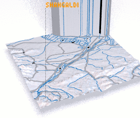 Places with similar names to Shāhgaldī, Iran ::
// Chakalite (BG)
// Chukilite (BG)
// Chikaldy (RU)
// Chuklayda (RU)
// Shacklett (US)
// Chak Kalādia (BD)
// Chhāgaldi (BD)
// Tiakalatou (BJ)
// Chacalluta (CL)
// Chuguldi (CO)
Disclaimer :: Information on this page comes without warranty of any kind |
||
|
Where is Shāhgaldī? Elevation and coordinates ::
Latitude (lat): 39°11'0"N Longitude (lon): 47°6'0"E
Elevation (approx.): 435m (map arrows pan, magnifying glasses zoom) |
||
|
Visiting Shāhgaldī? Hotel/Accommodation ::
Book a hotel in Shāhgaldī Travel Guide ::
Buy a travel guide for Iran rental cars ::
car rental offers GPS waypoint ::
download a GPX waypoint (PoI) of Shāhgaldī for your GPS receiver
|
||