|
search place name
|
||
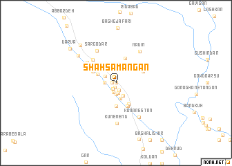
Shāh Samangān (Kermān, Iran)Shāh Samangān is a town in the Kermān region of Iran. An overview map of the region around Shāh Samangān is displayed below.
regional and 3d topo map of Shāh Samangān, Iran ::
Shāh Samangān airports ::
The nearest airport is KER - Kerman, located 160.0 km north west of Shāh Samangān.
Other airports nearby include BND - Bandar Abbass Intl (230.6 km south west), Nearby towns ::
Jamalī (0.0km north) //
Khorramshāhī (0.5km west) //
Akbarābād (0.7km south) //
Raz Shīrīn (1.1km south west) //
Dahaneh-ye Zovork (1.3km south) //
Sar Keyvān (1.5km south) //
Posht Sorkh (1.7km south) //
Bāgh-e Ḩabībollāh (1.6km west) //
Cheshmeh Mūrt (1.9km south) //
Zānū Rostam (1.9km north west) //
Raẕīābād (2.3km south east) //
Anjīr Bāzūʼīyeh (2.6km south) //
Dahaneh-ye Zangār (2.9km north west) //
Cheghūkū'īyeh (3.7km south) //
Koldān (3.9km south east) //
Māgh (3.7km north west) //
Māgh-e Pā'īn (3.7km north west) //
Şowlān (4.0km south east) //
Poleyshī (4.0km south east) //
Kūldūn (4.1km south east) //
Bandar-e Zevork (4.2km north) //
Kahn-e Mo'men (4.3km north west) //
Sarāb-e Kūhlarī (4.3km north east) //
Delfārd (4.4km north west) //
Bajgī (4.9km north west) //
Gorbeh (5.2km north west) //
Sar Godār (5.8km north west) //
Madīn (6.1km north east) //
Kūnemeng (6.6km south) //
[all distances 'as the bird flies' and approximate]  Places with similar names to Shāh Samangān, Iran :: Disclaimer :: Information on this page comes without warranty of any kind |
||
|
Where is Shāh Samangān? Elevation and coordinates ::
Latitude (lat): 28°58'0"N Longitude (lon): 57°39'0"E
Elevation (approx.): 1807m (map arrows pan, magnifying glasses zoom) |
||
|
Visiting Shāh Samangān? Hotel/Accommodation ::
Book a hotel in Shāh Samangān Travel Guide ::
Buy a travel guide for Iran rental cars ::
car rental offers GPS waypoint ::
download a GPX waypoint (PoI) of Shāh Samangān for your GPS receiver
|
||